Chestermere, Alberta
Creative production in Chestermere.
Film, photography and aerial cinematography for the homes, businesses and places that define Chestermere. Flat prairie built around a reservoir. The water is the only significant terrain feature, and it dominates every composition.
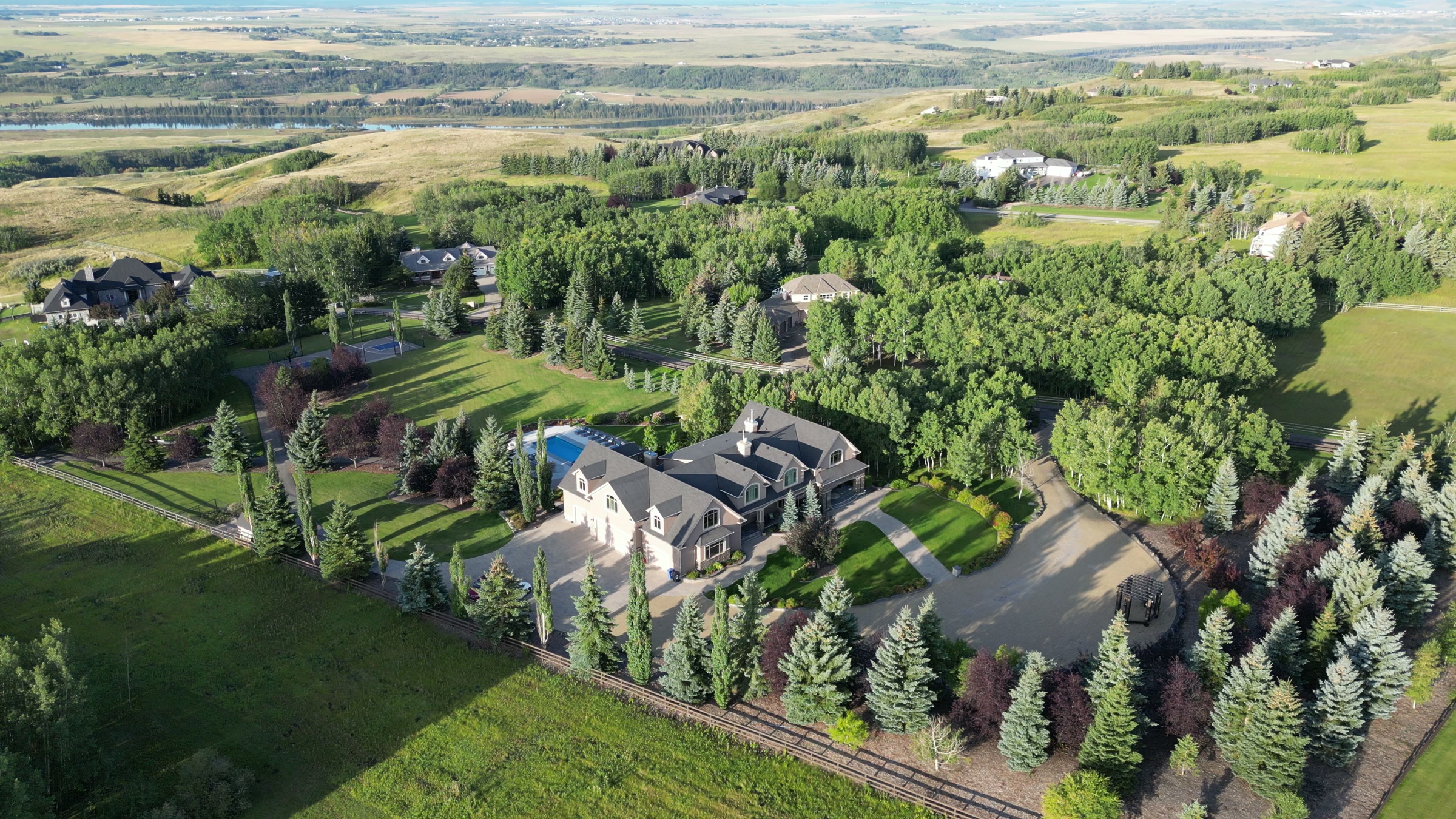
Does Atom2Adam work in Chestermere?
Yes. Atom2Adam makes film, photography and aerial cinematography in Chestermere, Alberta — for homes, businesses and brands. For aerial work the airspace is CYYC control zone outer edge. Flights are conducted under an Advanced RPAS certificate with airspace authorisation filed before the shoot is confirmed. Typical mobilisation from the Calgary studio is 25 minutes.
Chestermere at a glance
| Studio | Calgary, Alberta |
|---|---|
| Drive from the studio | 25 minutes |
| Airspace | CYYC control zone outer edge |
| Nearest aerodrome | Calgary International Airport (CYYC) |
| Aerial authorisation | Yes — filed before the date is confirmed |
| Aerial status | Flown under airspace authorisation |
| Certification | Transport Canada RPAS — Advanced Operations |
| Response | We reply within one business day |
| Airspace record derived | 2026-08-31 |
Working in Chestermere.
Chestermere is organised around a single body of water, and almost every premium address in the town is priced on its relationship to that shoreline. From the ground a lakefront home shows a fence and a dock. The lake itself — the reason for the price — is a strip of blue behind a hedge.
A shoreline orbit at altitude puts the house and the full water frontage in the same frame, which is the argument the listing is actually making.
Light. Ice-off through freeze-up is the window where the water reads as water. Under ice the lake photographs as a flat grey field and the lakefront argument disappears.
Terrain. Flat prairie built around a reservoir. The water is the only significant terrain feature, and it dominates every composition.
Wind. Open water with no shelter. Wind crossing the lake arrives unbroken, and surface chop is a reliable visual indicator of conditions aloft.
Airspace. The Calgary International control zone boundary runs through the Chestermere area rather than around it. Authorisation status is confirmed per address rather than assumed for the town. This is a corridor-level assessment; the specific address is confirmed against NAV Drone (opens in a new tab) before every flight.
On the ground. City of Chestermere rules govern launch and landing on municipal land and around the lake shoreline reserve. About 25 minutes east of the Calgary base. One of the shortest mobilisations in the service area.
What we make for Chestermere.
Every subject is approached the same way — creative direction, film, photography, aerial and post-production, scoped and quoted before anything is booked.
Chestermere and what surrounds it.
- Film and photography in Calgary18 km · Class C control zone (CYYC)
- Film and photography in Langdon13 km · Class G uncontrolled
- Film and photography in Conrich6 km · CYYC control zone vicinity
- Film and photography in Strathmore29 km · Class G uncontrolled
- Film and photography in Airdrie31 km · Mixed — control zone edge and local aerodrome
How a Chestermere shoot runs.
- 01Brief and scope. Chestermere lends itself to lakefront property and luxury homes; the shot list follows the subject. Mobilisation is stated separately from the fee.
- 02Airspace, where the brief includes aerial work. Chestermere sits under Calgary International Airport (CYYC), 18 km away. Authorisation is filed with NAV CANADA and the date is confirmed once it is in hand.
- 03Light and weather. Open water with no shelter. Wind crossing the lake arrives unbroken, and surface chop is a reliable visual indicator of conditions aloft. Ice-off through freeze-up is the window where the water reads as water. Under ice the lake photographs as a flat grey field and the lakefront argument disappears.
- 04Shoot day. About 25 minutes from the Calgary studio. Launch from the subject property with the owner's permission; city of Chestermere rules govern launch and landing on municipal land and around the lake shoreline reserve.
- 05Post-production and delivery. Edited, graded and finished for every format it will live in, delivered digitally — which is how owners of Chestermere property who live elsewhere can be served.
Chestermere questions, answered.
Can you fly a drone over Chestermere Lake?
Yes, with authorisation. The Calgary International control zone boundary runs through the Chestermere area, so authorisation status is confirmed per address. Shoreline work is flown under an Advanced RPAS certificate with that authorisation in hand.
When should a Chestermere lakefront listing be shot?
Between ice-off and freeze-up. Under ice the lake photographs as a flat grey field, and the waterfront premium the listing is built on simply does not appear in the frame.
Why does lakefront property need aerial photography specifically?
Because the value is a relationship, not an object. Ground photography can show the house or the water but rarely both, and it cannot show how much frontage the lot actually has. Altitude puts the whole argument in one frame.
Chestermere is 18 km from Calgary.
Mobilisation is quoted from the Calgary studio, so a shoot in Chestermere and one 18 km away in Calgary are priced differently even when the subject is identical.
Nearby
Airspace record derived from the published airspace geometry on . Rules change — the exact site is confirmed against NAV Drone before every flight.