Kathyrn, Alberta
Creative production in Kathyrn.
Film, photography and aerial cinematography for the homes, businesses and places that define Kathyrn. Broad, open grain land at the corridor's eastern edge, flat enough that the elevator carries the skyline alone; field pattern and the road grid supply all the structure in an aerial frame.
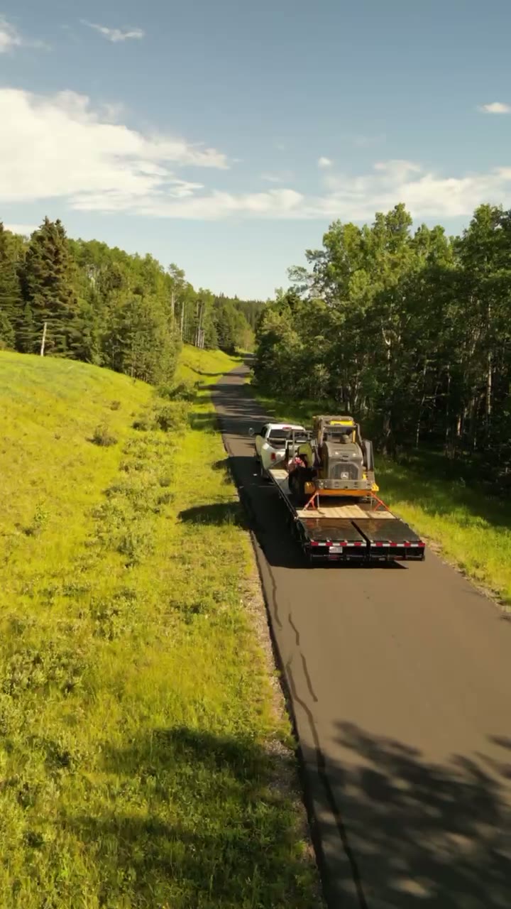
Does Atom2Adam work in Kathyrn?
Yes. Atom2Adam makes film, photography and aerial cinematography in Kathyrn, Alberta — for homes, businesses and brands. For aerial work the airspace is Class G uncontrolled. No airspace authorisation is normally required. Typical mobilisation from the Calgary studio is 45 minutes.
Kathyrn at a glance
| Studio | Calgary, Alberta |
|---|---|
| Drive from the studio | 45 minutes |
| Airspace | Class G uncontrolled |
| Nearest aerodrome | Beiseker aerodrome |
| Aerial authorisation | Not normally required |
| Aerial status | Standard RPAS rules apply |
| Certification | Transport Canada RPAS — Advanced Operations |
| Response | We reply within one business day |
| Airspace record derived | 2026-09-01 |
Working in Kathyrn.
Kathyrn keeps its grain elevator, and from the air it is the only vertical for miles — the hamlet's lots line up along Kathyrn Road facing it, the classic shape of a siding settlement with the elevator as its full stop. At ground level the elevator either dominates the frame or falls out of it. The relationship that gives Kathyrn its identity — a small grid of lots gathered around one tall working building — cannot be seen from a road shoulder at all.
An orbit flown at the elevator's height holds the landmark and the hamlet in one moving frame, and a rising reveal sets any property here against the structure that names the place — delivered on the turnaround agreed at booking.
Light. Harvest is the signature window — cut lines and swaths radiate from the hamlet and the elevator reads against worked fields. Green-up runs a close second, and midwinter reduces the scene to weathered wood on white.
Terrain. Broad, open grain land at the corridor's eastern edge, flat enough that the elevator carries the skyline alone; field pattern and the road grid supply all the structure in an aerial frame.
Wind. Open chinook-belt prairie. Wind that left the foothills hours earlier arrives here with nothing subtracted, and the elevator is tall enough to shed its own turbulence on the lee side, so orbits are planned with the wind in mind.
Airspace. Kathyrn lies outside the charted Calgary-area control zones in uncontrolled Class G airspace, about 19 km from Beiseker aerodrome. No airspace authorisation is normally required. The specific site and altitude are confirmed against NAV Drone before every flight.
On the ground. Rocky View County's rules cover municipal land and road allowances here; launch and landing are planned from private property with the owner's permission as the default. About 45 minutes from the Calgary base — the far edge of the corridor, so bookings here are grouped with Keoma or Delacour where possible and scheduled around the light rather than the drive.
What we make for Kathyrn.
Every subject is approached the same way — creative direction, film, photography, aerial and post-production, scoped and quoted before anything is booked.
Kathyrn and what surrounds it.
- Film and photography in Keoma7 km · Class G uncontrolled
- Film and photography in Delacour19 km · Class G uncontrolled
- Film and photography in Balzac34 km · Class C control zone (CYYC)
- Film and photography in Conrich27 km · CYYC control zone vicinity
- Film and photography in Langdon29 km · Class G uncontrolled
How a Kathyrn shoot runs.
- 01Brief and scope. Kathyrn lends itself to farms and ranch land and civic places and infrastructure; the shot list follows the subject. Mobilisation is stated separately from the fee.
- 02Airspace, where the brief includes aerial work. Checked against NAV Drone from the address, not the postcode. Kathyrn is class g uncontrolled, so authorisation is not normally required — but Beiseker aerodrome is 19 km away and its circuit is plotted regardless.
- 03Light and weather. Open chinook-belt prairie. Wind that left the foothills hours earlier arrives here with nothing subtracted, and the elevator is tall enough to shed its own turbulence on the lee side, so orbits are planned with the wind in mind. Harvest is the signature window — cut lines and swaths radiate from the hamlet and the elevator reads against worked fields. Green-up runs a close second, and midwinter reduces the scene to weathered wood on white.
- 04Shoot day. About 45 minutes from the Calgary studio. Launch from the subject property with the owner's permission; rocky View County's rules cover municipal land and road allowances here; launch and landing are planned from private property with the owner's permission as the default.
- 05Post-production and delivery. Edited, graded and finished for every format it will live in, delivered digitally — which is how owners of Kathyrn property who live elsewhere can be served.
Kathyrn questions, answered.
Is drone flight restricted around Kathyrn?
No. Kathyrn lies in uncontrolled Class G airspace outside the charted Calgary-area control zones, about 19 km from Beiseker aerodrome, so no authorisation is normally required. As with every flight, the specific site and altitude are confirmed against NAV Drone before the aircraft goes up.
Can you photograph the Kathyrn Grain Elevator?
Yes, with the landowner's permission for launch. The elevator is the strongest aerial subject in the hamlet — an orbit flown at its height holds the structure, the lots gathered around it and the open grain country beyond in one continuous shot that no ground position can offer.
Does the 45-minute drive change how a Kathyrn booking works?
Slightly. At about 45 minutes out, Kathyrn is the far edge of this corridor, so bookings are grouped where possible — a shoot here pairs naturally with Keoma or Delacour on the same trip. The schedule is planned around the light, because golden hour is the real constraint.
Kathyrn is 7 km from Keoma.
Every quote starts at the Calgary studio, which is why identical subjects in Kathyrn and Keoma — 7 km apart — price differently.
Nearby
Airspace record derived from the published airspace geometry on . Rules change — the exact site is confirmed against NAV Drone before every flight.