Cremona, Alberta
Creative production in Cremona.
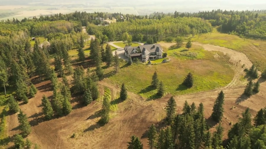
Film, photography and aerial cinematography for the homes, businesses and places that define Cremona. A village at the seam between cultivated prairie and the first rise of the foothills — flat, worked ground to the east and rolling, treed country climbing west toward Bergen Rocks.
Does Atom2Adam work in Cremona?
Yes. Atom2Adam makes film, photography and aerial cinematography in Cremona, Alberta — for homes, businesses and brands. For aerial work the airspace is Class G uncontrolled. No airspace authorisation is normally required. Typical mobilisation from the Calgary studio is 1 hours.
Cremona at a glance
| Studio | Calgary, Alberta |
|---|---|
| Drive from the studio | 1 hours |
| Airspace | Class G uncontrolled |
| Nearest aerodrome | Sundre aerodrome |
| Aerial authorisation | Not normally required |
| Aerial status | Standard RPAS rules apply |
| Certification | Transport Canada RPAS — Advanced Operations |
| Response | We reply within one business day |
| Airspace record derived | 2026-09-01 |
Working in Cremona.
The ground west of Cremona climbs toward Bergen Rocks, so the village loses direct evening sun to a raised horizon while the grain land east along Highway 580 is still lit. A shoot scheduled off a Calgary sunset table arrives to find the warm light already gone at ground level, and the frames meant to sell the foothill setting go flat.
The golden-hour hold is planned against Cremona's own horizon rather than the almanac — flown in the window that actually exists and delivered on the turnaround agreed at booking.
Light. Evening light gives out early once the sun drops behind the rising ground west of the village; mornings, lit from over the flat grain land, are the more predictable end of the day. Snow holds on the treed western rises after the fields have cleared.
Terrain. A village at the seam between cultivated prairie and the first rise of the foothills — flat, worked ground to the east and rolling, treed country climbing west toward Bergen Rocks.
Wind. Chinook belt. West wind comes off the foothills with the gust spread already built in, and the open ground along Highway 22 gives it nothing to slow against.
Airspace. Cremona lies outside the charted Calgary-area control zones in uncontrolled Class G airspace, about 29 km from Sundre aerodrome. No airspace authorisation is normally required. Every flight is preceded by a NAV Drone check of the specific site and altitude.
On the ground. Village of Cremona park and pathway rules govern launch and landing on municipal land; takeoff from private property with the owner's consent is the default. About an hour northwest of the Calgary base via Highway 22. Same-day is possible with a morning confirmation, and Water Valley or Dog Pound can share the same mobilisation.
What we make for Cremona.
Every subject is approached the same way — creative direction, film, photography, aerial and post-production, scoped and quoted before anything is booked.
Cremona and what surrounds it.
- Film and photography in Water Valley10 km · Class G uncontrolled
- Film and photography in Madden20 km · Class G uncontrolled
- Film and photography in Cochrane40 km · Class G uncontrolled
- Film and photography in Dog Pound8 km · Class G uncontrolled
- Film and photography in Bragg Creek67 km · Class G uncontrolled
How a Cremona shoot runs.
- 01Brief and scope. Cremona lends itself to luxury homes and new communities and show homes; the shot list follows the subject. Mobilisation is stated separately from the fee.
- 02Airspace, where the brief includes aerial work. Checked against NAV Drone from the address, not the postcode. Cremona is class g uncontrolled, so authorisation is not normally required — but Sundre aerodrome is 29 km away and its circuit is plotted regardless.
- 03Light and weather. Chinook belt. West wind comes off the foothills with the gust spread already built in, and the open ground along Highway 22 gives it nothing to slow against. Evening light gives out early once the sun drops behind the rising ground west of the village; mornings, lit from over the flat grain land, are the more predictable end of the day. Snow holds on the treed western rises after the fields have cleared.
- 04Shoot day. About 60 minutes from the Calgary studio. Launch from the subject property with the owner's permission; village of Cremona park and pathway rules govern launch and landing on municipal land; takeoff from private property with the owner's consent is the default.
- 05Post-production and delivery. Edited, graded and finished for every format it will live in, delivered digitally — which is how owners of Cremona property who live elsewhere can be served.
Cremona questions, answered.
Is Cremona inside any controlled airspace?
No. Cremona sits in uncontrolled Class G airspace, outside the charted Calgary-area control zones, with the nearest aerodrome at Sundre about 29 km away. No airspace authorisation is normally required to fly here. The specific site and altitude are still confirmed against NAV Drone before every flight.
When is the best light for an aerial shoot in Cremona?
Morning, or the hour before the sun reaches the foothill horizon. The ground climbs west of the village toward Bergen Rocks, so direct evening light ends earlier than sunset tables suggest. Booking against that earlier cutoff keeps the golden-hour frames on the schedule instead of off it.
Can one booking cover Cremona and a nearby property?
Yes. Cremona, Water Valley and Dog Pound sit on the same run from Calgary, so two sites can share one mobilisation. The hour's drive from the base means the practical approach is a half-day window, with the order of sites set by the light.
Cremona is 10 km from Water Valley.
Because mobilisation is quoted from the Calgary studio, Cremona and Water Valley, 10 km away, carry different quotes for an identical subject.
Nearby
Airspace record derived from the published airspace geometry on . Rules change — the exact site is confirmed against NAV Drone before every flight.