Sagewood, Alberta
Creative production in Sagewood.
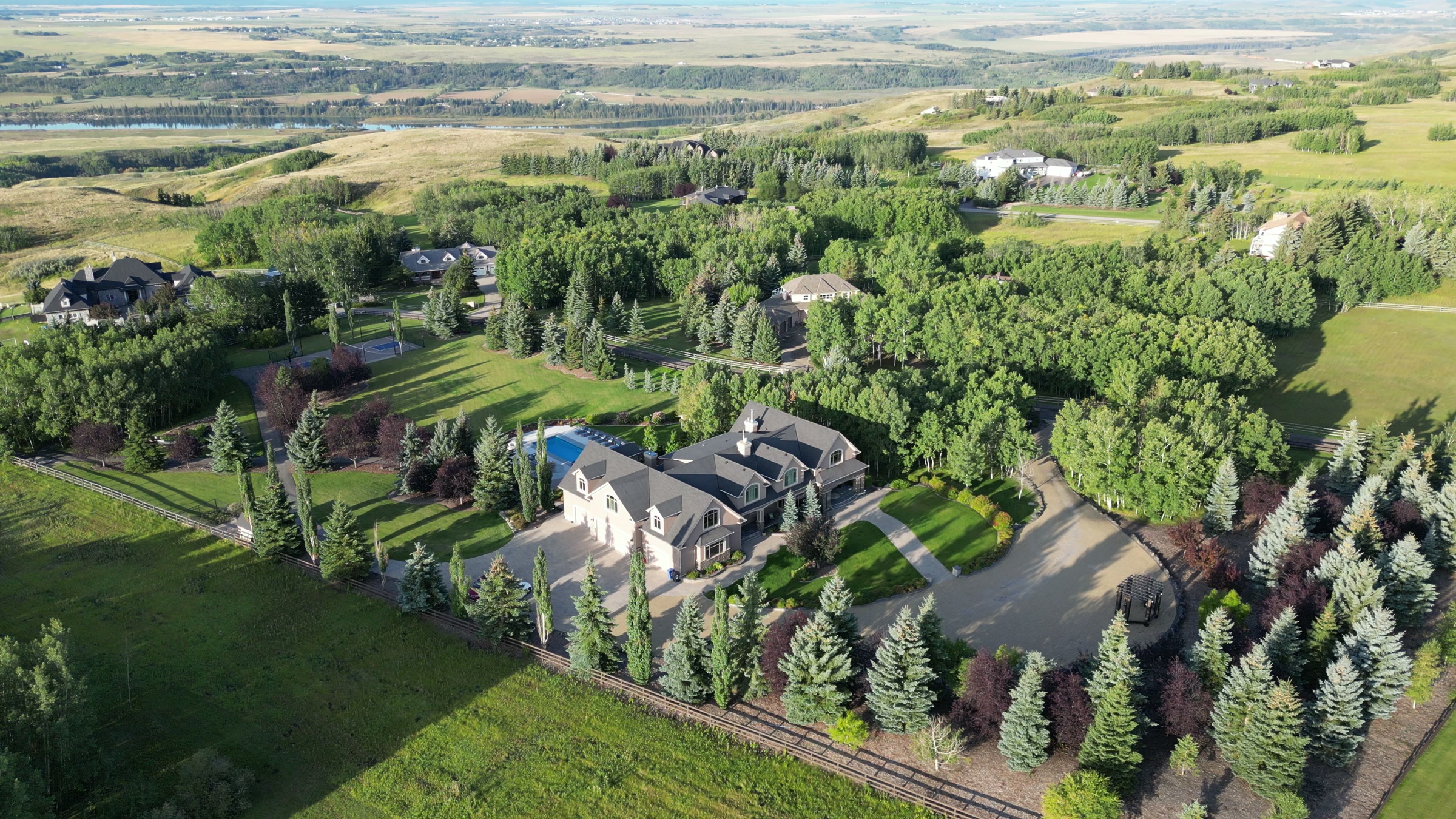
Film, photography and aerial cinematography for the homes, businesses and places that define Sagewood. Near-level ground on Airdrie's northwest side where the built plane is interrupted only by cut features — the Canals waterway threading between lots and the green fall of Woodside Golf Course.
Does Atom2Adam work in Sagewood?
Yes. Atom2Adam makes film, photography and aerial cinematography in Sagewood, Alberta — for homes, businesses and brands. For aerial work the airspace is Mixed — control zone edge and local aerodrome. Aerial work here flies under an Advanced RPAS certificate, and the airspace authorisation is filed before any shoot date is confirmed. Typical mobilisation from the Calgary studio is 30 minutes.
Sagewood at a glance
| Studio | Calgary, Alberta |
|---|---|
| Drive from the studio | 30 minutes |
| Airspace | Mixed — control zone edge and local aerodrome |
| Nearest aerodrome | Airdrie aerodrome |
| Aerial authorisation | Yes — filed before the date is confirmed |
| Aerial status | Flown under airspace authorisation |
| Certification | Transport Canada RPAS — Advanced Operations |
| Response | We reply within one business day |
| Airspace record derived | 2026-09-01 |
Working in Sagewood.
Such relief as Sagewood has is cut downward, not raised — the Canals waterway and the fairway contours of Woodside Golf Course sit below the level of the streets, invisible behind fence lines from the ground. The community's two best features are the two a ground camera cannot see; a listing that backs onto water or fairway photographs, at street level, like a listing that backs onto neither.
A boundary-line orbit flown along the water or the course edge restores the missing geography — home, channel and fairway in one frame — delivered on the turnaround agreed at booking.
Light. The water and the fairways run the calendar — open water and green turf from ice-off to freeze-up give Sagewood frames their colour, autumn turns the course for a short window, and winter reduces the waterway to a clean white line through the rooftops.
Terrain. Near-level ground on Airdrie's northwest side where the built plane is interrupted only by cut features — the Canals waterway threading between lots and the green fall of Woodside Golf Course.
Wind. The chinook belt, unsheltered. Neither the shallow cut of the Canals waterway nor the golf course tree lines amount to real wind protection; flight windows are planned against Airdrie's own exposed-prairie conditions.
Airspace. Sagewood shares its airspace corridor with Airdrie, about 1 km away, and flights through it are planned as controlled airspace. An Advanced RPAS certificate covers the work, with NAV CANADA RPAS authorisation obtained wherever the specific site requires it. Before any flight, the exact site and altitude are checked against NAV Drone.
On the ground. Takeoff and landing on Sagewood's municipal land — parks, pathways and the waterway edges — is governed by City of Airdrie rules, so launches stage from private property with the owner's permission. About 30 minutes north of the Calgary base on the city's northwest side — an easy pairing with Luxstone or Bayside, and with Crossfield if the run continues north.
What we make for Sagewood.
Every subject is approached the same way — creative direction, film, photography, aerial and post-production, scoped and quoted before anything is booked.
Sagewood and what surrounds it.
- Film and photography in Luxstone1 km · Mixed — control zone edge and local aerodrome
- Film and photography in Bayside2 km · Mixed — control zone edge and local aerodrome
- Film and photography in Airdrie Downtown1 km · Mixed — control zone edge and local aerodrome
- Film and photography in Crossfield14 km · Class G uncontrolled
- Film and photography in Airdrie1 km · Mixed — control zone edge and local aerodrome
How a Sagewood shoot runs.
- 01Brief and scope. Sagewood lends itself to lakefront property and luxury homes; the shot list follows the subject. Mobilisation is stated separately from the fee.
- 02Airspace, where the brief includes aerial work. Sagewood sits under Airdrie aerodrome, 7 km away. Authorisation is filed with NAV CANADA and the date is confirmed once it is in hand.
- 03Light and weather. The chinook belt, unsheltered. Neither the shallow cut of the Canals waterway nor the golf course tree lines amount to real wind protection; flight windows are planned against Airdrie's own exposed-prairie conditions. The water and the fairways run the calendar — open water and green turf from ice-off to freeze-up give Sagewood frames their colour, autumn turns the course for a short window, and winter reduces the waterway to a clean white line through the rooftops.
- 04Shoot day. About 30 minutes from the Calgary studio. Launch from the subject property with the owner's permission; takeoff and landing on Sagewood's municipal land — parks, pathways and the waterway edges — is governed by City of Airdrie rules, so launches stage from private property with the owner's permission.
- 05Post-production and delivery. Edited, graded and finished for every format it will live in, delivered digitally — which is how owners of Sagewood property who live elsewhere can be served.
Sagewood questions, answered.
Is authorisation needed for a drone shoot in Sagewood?
Generally, yes — wherever the specific site calls for it. Sagewood sits in the same corridor as Airdrie, about 1 km out, planned as controlled airspace, with the Airdrie aerodrome roughly 7 km away. Work is flown under an Advanced RPAS certificate, and each site and altitude is confirmed against NAV Drone beforehand.
Can you photograph a home backing onto Woodside Golf Course?
Yes, and without flying over play. An orbit along the property line keeps the house large while the fairway fills the background; if a frame truly requires crossing the course, it is agreed with the course first. Book in the green season — the fairway colour is most of the argument for the frontage.
Sagewood is 1 km from Luxstone.
Mobilisation is quoted from the Calgary studio, so a shoot in Sagewood and one 1 km away in Luxstone are priced differently even when the subject is identical.
Nearby
Airspace record derived from the published airspace geometry on . Rules change — the exact site is confirmed against NAV Drone before every flight.