Springbank, Alberta
Creative production in Springbank.
Film, photography and aerial cinematography for the homes, businesses and places that define Springbank. Open rolling upland between the Elbow and Bow valleys. Long sightlines west to the front ranges, with shallow coulees breaking the parcels.
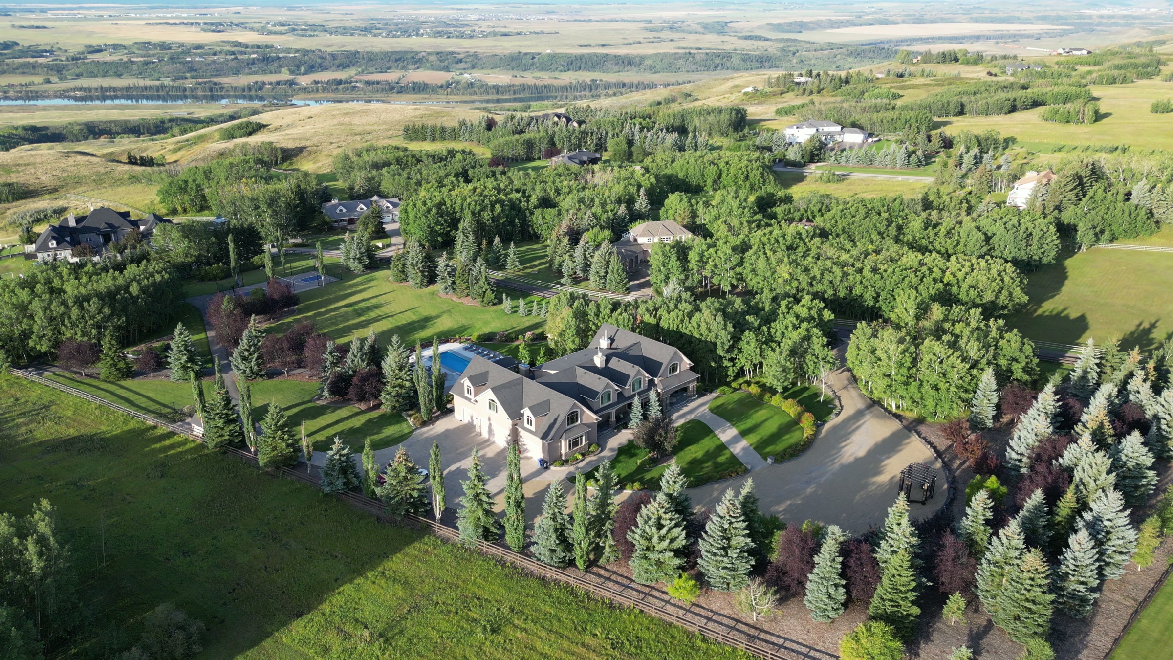
Does Atom2Adam work in Springbank?
Yes. Atom2Adam makes film, photography and aerial cinematography in Springbank, Alberta — for homes, businesses and brands. For aerial work the airspace is Class C control zone (CYBW). Aerial work here flies under an Advanced RPAS certificate, and the airspace authorisation is filed before any shoot date is confirmed. Typical mobilisation from the Calgary studio is 25 minutes.
Springbank at a glance
| Studio | Calgary, Alberta |
|---|---|
| Drive from the studio | 25 minutes |
| Airspace | Class C control zone (CYBW) |
| Nearest aerodrome | Springbank Airport (CYBW) |
| Aerial authorisation | Yes — filed before the date is confirmed |
| Aerial status | Flown under airspace authorisation |
| Certification | Transport Canada RPAS — Advanced Operations |
| Response | We reply within one business day |
| Airspace record derived | 2026-08-31 |
Working in Springbank.
Springbank Airport runs a high volume of circuit training, which means the airspace directly above these acreages is genuinely active most fine-weather days. A Basic-certificate operator cannot legally be here at all, so the certificate held decides whether the shoot happens.
Advanced RPAS certification plus authorisation filed at booking means the Springbank date holds for the same reasons any other date holds — weather, not paperwork.
Light. West-facing with an open mountain horizon, so late light is the strongest. Snow lies longer on this upland than in the city below.
Terrain. Open rolling upland between the Elbow and Bow valleys. Long sightlines west to the front ranges, with shallow coulees breaking the parcels.
Wind. Elevated and exposed to the chinook. West wind arrives off the foothills with little to slow it and builds through the afternoon.
Airspace. Springbank sits inside or immediately adjacent to the Springbank Airport control zone. CYBW is one of Canada's busier training fields, so authorisation here is part of every booking rather than an exception — and it is filed before every shoot. This is a corridor-level assessment; the specific address is confirmed against NAV Drone (opens in a new tab) before every flight.
On the ground. Rocky View County governs land use here. Launch and landing are arranged on the subject property with the owner's permission. About 25 minutes west of the Calgary base on Highway 8 or Highway 1. Same-day capable, subject to the CYBW authorisation being in hand.
What we make for Springbank.
Every subject is approached the same way — creative direction, film, photography, aerial and post-production, scoped and quoted before anything is booked.
Springbank and what surrounds it.
- Film and photography in Elbow Valley8 km · Class C control zone (CYBW) vicinity
- Film and photography in Bearspaw9 km · Mixed — CYBW control zone boundary
- Film and photography in Aspen Woods12 km · Controlled — between CYYC and CYBW
- Film and photography in Cochrane14 km · Class G uncontrolled
- Film and photography in Bragg Creek20 km · Class G uncontrolled
How a Springbank shoot runs.
- 01Brief and scope. Springbank lends itself to acreages and estates and luxury homes; the shot list follows the subject. Mobilisation is stated separately from the fee.
- 02Airspace, where the brief includes aerial work. Springbank sits under Springbank Airport (CYBW), 3 km away. Authorisation is filed with NAV CANADA and the date is confirmed once it is in hand.
- 03Light and weather. Elevated and exposed to the chinook. West wind arrives off the foothills with little to slow it and builds through the afternoon. West-facing with an open mountain horizon, so late light is the strongest. Snow lies longer on this upland than in the city below.
- 04Shoot day. About 25 minutes from the Calgary studio. Launch from the subject property with the owner's permission; rocky View County governs land use here. Launch and landing are arranged on the subject property with the owner's permission.
- 05Post-production and delivery. Edited, graded and finished for every format it will live in, delivered digitally — which is how owners of Springbank property who live elsewhere can be served.
Springbank questions, answered.
Do you need authorisation to fly a drone in Springbank?
Yes. Springbank sits inside or immediately adjacent to the Springbank Airport (CYBW) Class C control zone. Flights require an Advanced RPAS certificate and a NAV CANADA authorisation, which is filed before the shoot date is confirmed.
Can a Basic RPAS certificate be used in Springbank?
Because a Basic RPAS certificate does not permit operations in controlled airspace, and CYBW is an active training field. An Advanced certificate and a filed authorisation are the only lawful route in.
What does aerial photography show on a Springbank acreage that ground photography cannot?
The parcel itself. From the driveway a five-acre property looks like a house and some trees. From altitude the buyer sees the actual boundary, the approach, the usable land and the mountain sightline they are paying a premium for.
Springbank is 8 km from Elbow Valley.
Mobilisation is quoted from the Calgary studio, so a shoot in Springbank and one 8 km away in Elbow Valley are priced differently even when the subject is identical.
Nearby
Airspace record derived from the published airspace geometry on . Rules change — the exact site is confirmed against NAV Drone before every flight.