Elbow Valley, Alberta
Creative production in Elbow Valley.
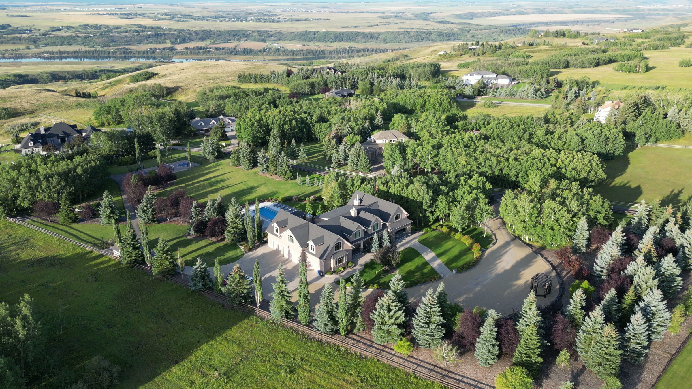
Film, photography and aerial cinematography for the homes, businesses and places that define Elbow Valley. A wooded river valley with estate lots stepping down toward the Elbow. Dense mature canopy and significant lot-to-lot elevation change.
Does Atom2Adam work in Elbow Valley?
Yes. Atom2Adam makes film, photography and aerial cinematography in Elbow Valley, Alberta — for homes, businesses and brands. For aerial work the airspace is Class C control zone (CYBW) vicinity. An Advanced RPAS certificate covers the flight, with airspace authorisation in place before the booking is confirmed. Typical mobilisation from the Calgary studio is 25 minutes.
Elbow Valley at a glance
| Studio | Calgary, Alberta |
|---|---|
| Drive from the studio | 25 minutes |
| Airspace | Class C control zone (CYBW) vicinity |
| Nearest aerodrome | Springbank Airport (CYBW) |
| Aerial authorisation | Yes — filed before the date is confirmed |
| Aerial status | Flown under airspace authorisation |
| Certification | Transport Canada RPAS — Advanced Operations |
| Response | We reply within one business day |
| Airspace record derived | 2026-08-31 |
Working in Elbow Valley.
The Elbow Valley corridor is one of the few places in the region where estate housing sits directly against a working river valley and mature forest. Tree canopy hides most of what a buyer wants to see — the water, the lot depth, and how much of the parcel is actually open ground.
A pass flown just above canopy height reveals the property's true footprint against the valley without losing the sense of enclosure that sells it.
Light. Leaf-off in late autumn and early spring is when the water and the lot boundaries are actually visible through the canopy.
Terrain. A wooded river valley with estate lots stepping down toward the Elbow. Dense mature canopy and significant lot-to-lot elevation change.
Wind. The valley shelters the floor but accelerates wind across the upper benches — conditions vary sharply over short distances.
Airspace. The Elbow Valley corridor sits within the Springbank control zone's area of influence. Authorisation is filed per site before the shoot is confirmed. This is a corridor-level assessment; the specific address is confirmed against NAV Drone (opens in a new tab) before every flight.
On the ground. Rocky View County rules apply; the Elbow River corridor carries additional environmental-reserve restrictions. About 25 minutes west of the Calgary base on Highway 8. Same-day capable subject to authorisation.
What we make for Elbow Valley.
Every subject is approached the same way — creative direction, film, photography, aerial and post-production, scoped and quoted before anything is booked.
Elbow Valley and what surrounds it.
- Film and photography in Springbank8 km · Class C control zone (CYBW)
- Film and photography in Bragg Creek18 km · Class G uncontrolled
- Film and photography in Aspen Woods9 km · Controlled — between CYYC and CYBW
- Film and photography in Bearspaw15 km · Mixed — CYBW control zone boundary
- Film and photography in Priddis15 km · Class G uncontrolled
How an Elbow Valley shoot runs.
- 01Brief and scope. Elbow Valley lends itself to acreages and estates and luxury homes; the shot list follows the subject. Mobilisation is stated separately from the fee.
- 02Airspace, where the brief includes aerial work. Elbow Valley sits under Springbank Airport (CYBW), 7 km away. Authorisation is filed with NAV CANADA and the date is confirmed once it is in hand.
- 03Light and weather. The valley shelters the floor but accelerates wind across the upper benches — conditions vary sharply over short distances. Leaf-off in late autumn and early spring is when the water and the lot boundaries are actually visible through the canopy.
- 04Shoot day. About 25 minutes from the Calgary studio. Launch from the subject property with the owner's permission; rocky View County rules apply; the Elbow River corridor carries additional environmental-reserve restrictions.
- 05Post-production and delivery. Edited, graded and finished for every format it will live in, delivered digitally — which is how owners of Elbow Valley property who live elsewhere can be served.
Elbow Valley questions, answered.
Can you fly a drone in Elbow Valley?
Yes, with authorisation. The corridor sits within the Springbank (CYBW) control zone's area of influence, so flights are conducted under an Advanced RPAS certificate with a NAV CANADA authorisation filed before the shoot.
Does tree cover affect an Elbow Valley aerial shoot?
Significantly. Mature canopy hides lot depth, river frontage and open ground — the three things an estate buyer most wants to assess. Leaf-off in late autumn or early spring gives a far more honest picture of the parcel.
What altitude works best for wooded estate lots?
Just above canopy height for the reveal, rising for the plan view. Flying too high loses the sense of enclosure that makes a wooded lot desirable; staying too low hides the boundary entirely.
Elbow Valley is 8 km from Springbank.
Mobilisation is quoted from the Calgary studio, so a shoot in Elbow Valley and one 8 km away in Springbank are priced differently even when the subject is identical.
Nearby
Airspace record derived from the published airspace geometry on . Rules change — the exact site is confirmed against NAV Drone before every flight.