Aerial · Aerial photography
Altitude is not a camera position. It is an argument.
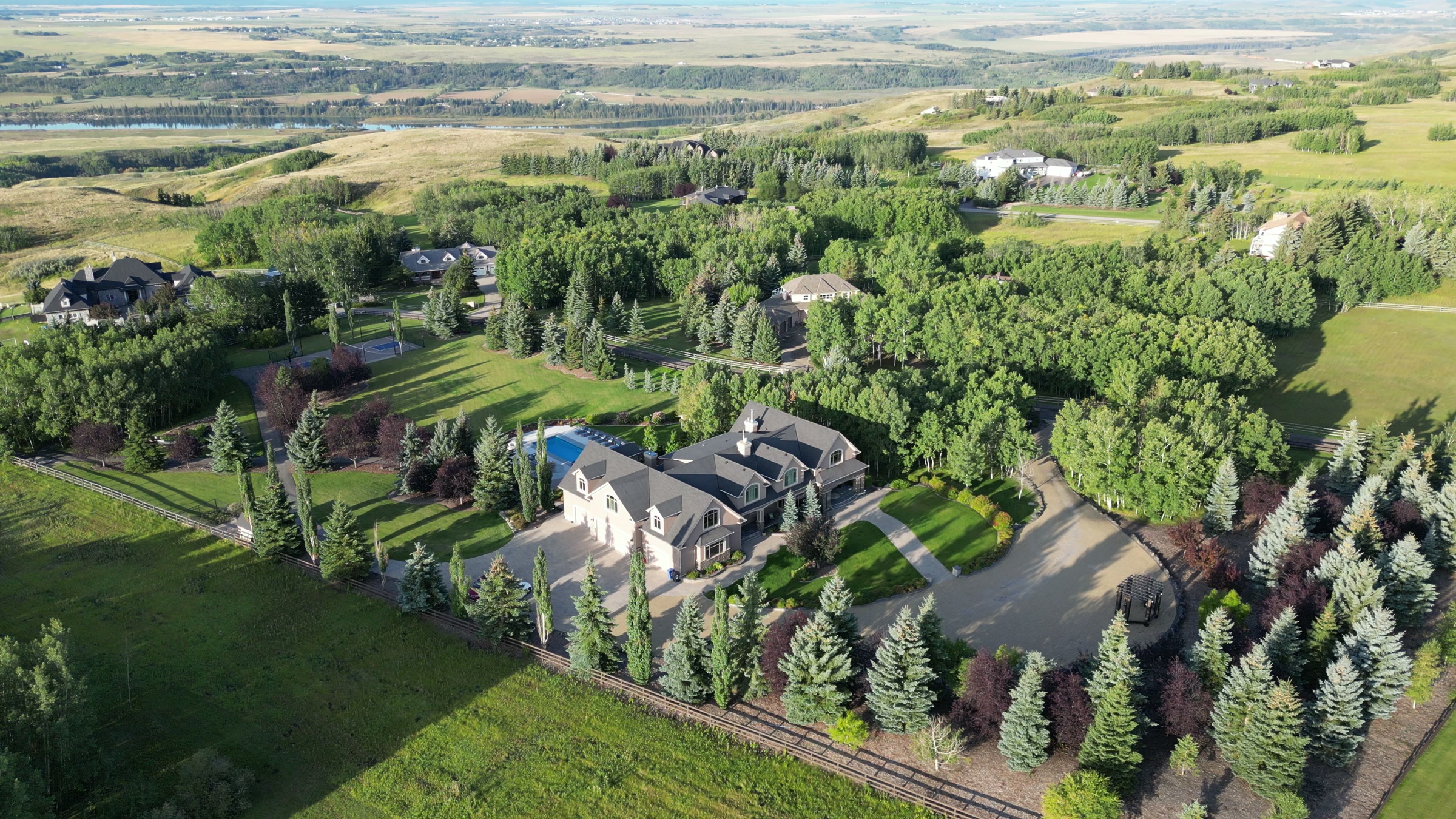
Every photograph taken from the ground makes the same implicit claim: that what you can see is what matters. A frame from altitude makes a different one — that a building is a relationship between itself, the land it sits on and everything around it. That relationship is what we photograph.
Does Atom2Adam offer aerial photography?
Yes. Aerial photography is one capability of Atom2Adam, a creative production studio in Calgary working across film, photography, aerial and post-production. Stills are flown for architecture, property, land and campaign work across Alberta and British Columbia under a Transport Canada Advanced RPAS certificate, with NAV CANADA authorisation filed for any address inside controlled airspace — which covers most of Calgary.
The craft.
What separates a good version of this work from a bad one.
- 01
Altitude is chosen from the subject, not the airframe
A five-acre parcel needs enough height to show the boundary and not so much that the house becomes a roof. Too high is the most common failure in aerial work, and it is the one that makes every property look identical.
- 02
The light decides the day, not the calendar
Low raking light separates terrain, grade and texture. Overhead midday sun flattens all three. A west-facing subject in the foothills has roughly one usable hour, and booking outside it wastes the flight.
- 03
The frame includes what the buyer is actually paying for
Mountain sightline, water frontage, road access, acreage. Those are the priced features, and none of them exist in a photograph taken from the driveway.
- 04
Colour is managed, not filtered
An aerial still is graded in the same colour language as the film and the ground photography it sits beside, so a set reads as one project rather than a collection of frames from different days.
What is delivered.
Aerial work is delivered inside the commission, graded in the same colour language as everything beside it. How a commission is structured.
Deliverables
- High-resolution stills, colour-managed
- Web derivatives sized for the site, the listing or the campaign
- Plan-view frames for boundary and access
- Camera originals where the commission calls for them
Commonly commissioned for
- Property where lot, approach or sightline carries the value
- Architecture and landscape
- Venues, resorts and hospitality
- Brand and campaign imagery
Questions, answered.
How high does a drone fly for property photography?
It depends on the subject rather than the limit. A single home usually reads best well below the regulatory ceiling; a large parcel needs enough height to contain the boundary. Flying as high as legally possible is the most common mistake in aerial work, and it is why so much of it looks the same.
What time of day is best for aerial property photography?
The hour before sunset for most subjects, because low raking light separates grade, texture and terrain. Overhead midday sun flattens all three. West-facing foothills properties have a particularly narrow window, and the shoot is scheduled around it rather than around the calendar.
Do you need a licence to take aerial photographs commercially in Canada?
Yes. Commercial operation requires a Transport Canada RPAS Pilot Certificate. Advanced Operations is the level needed to fly in controlled airspace or near bystanders, which covers most addresses in urban Alberta. Atom2Adam flies under an Advanced certificate and files NAV CANADA authorisation where the address requires it.