Chelsea, Alberta
Creative production in Chelsea.
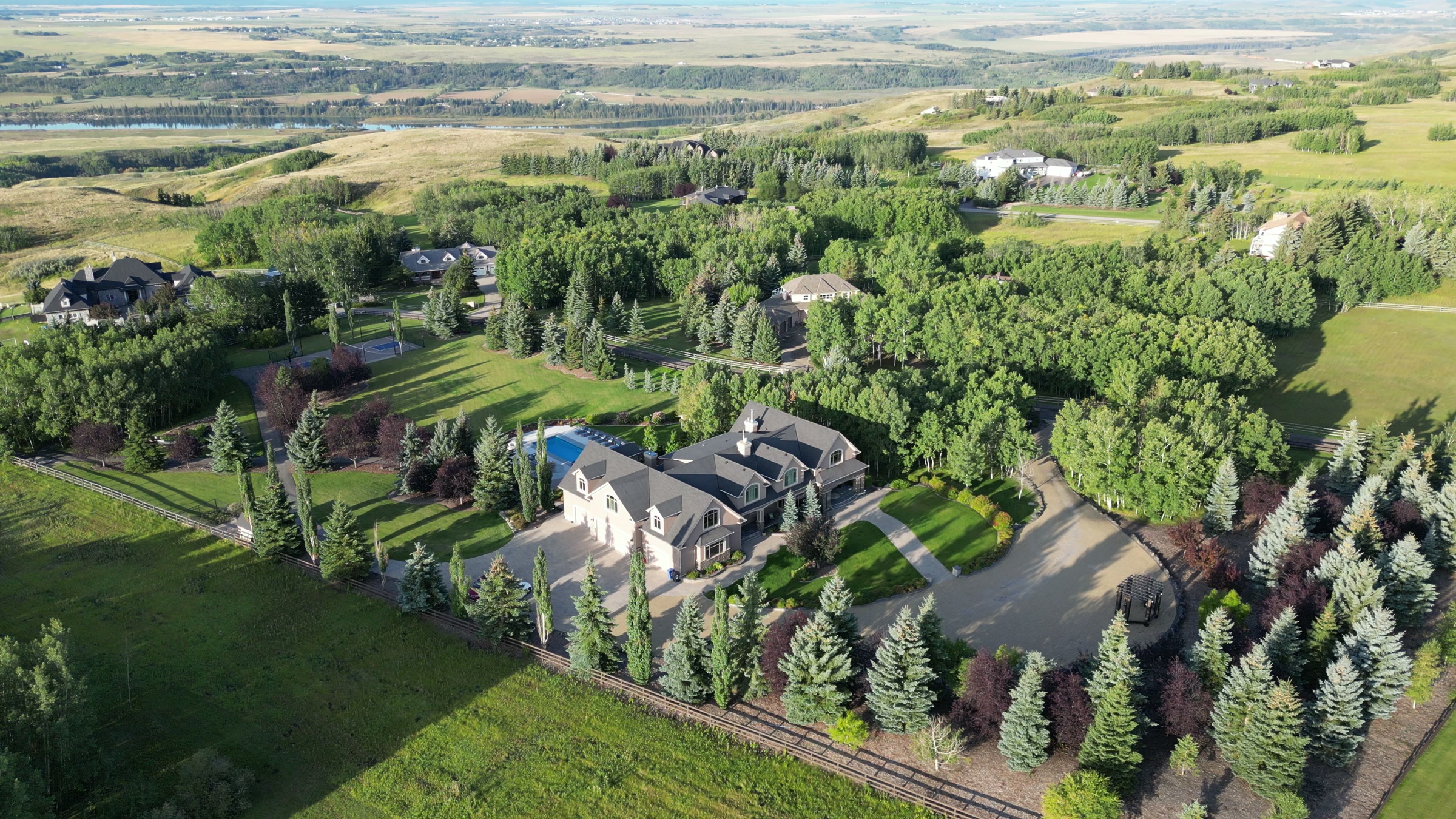
Film, photography and aerial cinematography for the homes, businesses and places that define Chelsea. Flat prairie at Chestermere's western edge, mid-conversion from cultivated ground to subdivision — new road network and graded lots on one side of the frame, open field on the other.
Does Atom2Adam work in Chelsea?
Yes. Atom2Adam makes film, photography and aerial cinematography in Chelsea, Alberta — for homes, businesses and brands. For aerial work the airspace is CYYC control zone outer edge. An Advanced RPAS certificate covers the flight, with airspace authorisation in place before the booking is confirmed. Typical mobilisation from the Calgary studio is 25 minutes.
Chelsea at a glance
| Studio | Calgary, Alberta |
|---|---|
| Drive from the studio | 25 minutes |
| Airspace | CYYC control zone outer edge |
| Nearest aerodrome | Calgary International Airport (CYYC) |
| Aerial authorisation | Yes — filed before the date is confirmed |
| Aerial status | Flown under airspace authorisation |
| Certification | Transport Canada RPAS — Advanced Operations |
| Response | We reply within one business day |
| Airspace record derived | 2026-09-01 |
Working in Chelsea.
Chelsea's roads are finished before its streetscape is — from the air, Chelsea Boulevard and the streets branching from it read as a complete, curbed network laid over ground the houses have not caught up to yet. A ground-level photograph of a new build here frames bare lots, hoarding and unplanted boulevards — the buyer sees a construction site, not the community the plan promises or how close it sits to Chestermere Lake.
An elevated frame down the line of Chelsea Boulevard shows the finished network, the build edge and the lake in one composition, and a repeat progress series flown to the same waypoints tracks the community filling in — delivered on the turnaround agreed at booking.
Light. Green-up flatters a part-built community: sod and open field read green together and the raw edges soften. Snow erases the difference between finished yards and bare lots, which suits progress documentation better than sales frames.
Terrain. Flat prairie at Chestermere's western edge, mid-conversion from cultivated ground to subdivision — new road network and graded lots on one side of the frame, open field on the other.
Wind. Chinook belt with nothing upwind. West wind arrives off open prairie unbroken, a building site offers no shelter, and bare graded ground throws dust in a dry blow.
Airspace. About 1 km from Chestermere and in the same airspace corridor, Chelsea is planned as controlled airspace. Operations run under an Advanced RPAS certificate, and a NAV CANADA RPAS authorisation is obtained wherever the specific site calls for one. The specific site and altitude are confirmed against NAV Drone before every flight.
On the ground. City of Chestermere park and pathway rules govern takeoff and landing on municipal land, including Chelsea Ridge Park; launches are staged from private property with the client's consent. About 25 minutes east of the Calgary base. Same-day is realistic once the authorisation position is confirmed, and Westmere or West Creek pair naturally on the same trip.
What we make for Chelsea.
Every subject is approached the same way — creative direction, film, photography, aerial and post-production, scoped and quoted before anything is booked.
Chelsea and what surrounds it.
- Film and photography in Chestermere1 km · CYYC control zone outer edge
- Film and photography in Kinniburgh2 km · CYYC control zone outer edge
- Film and photography in Westmere2 km · CYYC control zone outer edge
- Film and photography in West Creek1 km · CYYC control zone outer edge
- Film and photography in Dawson's Landing1 km · CYYC control zone outer edge
How a Chelsea shoot runs.
- 01Brief and scope. Chelsea lends itself to new communities and show homes and luxury homes; the shot list follows the subject. Mobilisation is stated separately from the fee.
- 02Airspace, where the brief includes aerial work. Chelsea sits under Calgary International Airport (CYYC), 16 km away. Authorisation is filed with NAV CANADA and the date is confirmed once it is in hand.
- 03Light and weather. Chinook belt with nothing upwind. West wind arrives off open prairie unbroken, a building site offers no shelter, and bare graded ground throws dust in a dry blow. Green-up flatters a part-built community: sod and open field read green together and the raw edges soften. Snow erases the difference between finished yards and bare lots, which suits progress documentation better than sales frames.
- 04Shoot day. About 25 minutes from the Calgary studio. Launch from the subject property with the owner's permission; city of Chestermere park and pathway rules govern takeoff and landing on municipal land, including Chelsea Ridge Park; launches are staged from private property with the client's consent.
- 05Post-production and delivery. Edited, graded and finished for every format it will live in, delivered digitally — which is how owners of Chelsea property who live elsewhere can be served.
Chelsea questions, answered.
Do drone flights in Chelsea need NAV CANADA authorisation?
Often, yes. Chelsea sits on the outer edge of the Calgary International (CYYC) control zone, about 16 km from the airport, so flights here are planned as controlled airspace. Atom2Adam flies under an Advanced RPAS certificate, files a NAV CANADA authorisation wherever the site requires one, and confirms every address against NAV Drone first.
Can you document a build in Chelsea over several months?
Yes. A progress series is flown to the same waypoints, altitudes and headings on each visit, so the frames align and the change is the only thing that moves. The 25-minute drive from Calgary keeps repeat visits practical to schedule around weather and light.
What does aerial photography add to a new-build listing in Chelsea?
Context the curb cannot show. In a community still building out, the aerial places a finished home within the road network, shows the open prairie behind it, and puts Chestermere Lake and the Chestermere Recreation Centre in frame — the amenities a ground photograph has to leave out.
Chelsea is 1 km from Chestermere.
Every quote starts at the Calgary studio, which is why identical subjects in Chelsea and Chestermere — 1 km apart — price differently.
Nearby
Airspace record derived from the published airspace geometry on . Rules change — the exact site is confirmed against NAV Drone before every flight.