Dawson's Landing, Alberta
Creative production in Dawson's Landing.
Film, photography and aerial cinematography for the homes, businesses and places that define Dawson's Landing. Flat prairie at the south end of Chestermere, threaded by the canal system that feeds and drains the lake — the water lines are the only geometry the survey grid does not control.
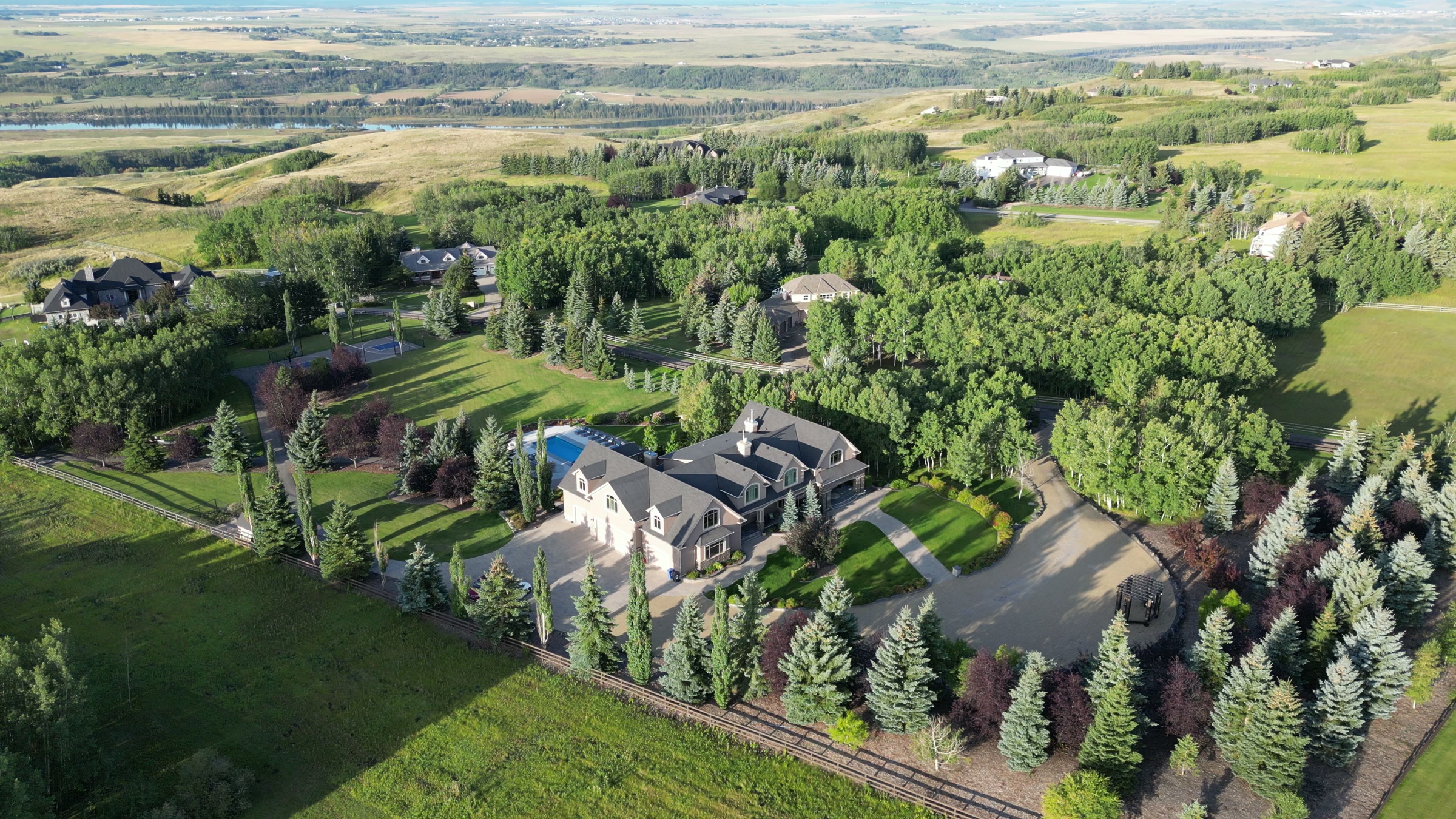
Does Atom2Adam work in Dawson's Landing?
Yes. Atom2Adam makes film, photography and aerial cinematography in Dawson's Landing, Alberta — for homes, businesses and brands. For aerial work the airspace is CYYC control zone outer edge. An Advanced RPAS certificate covers the flight, with airspace authorisation in place before the booking is confirmed. Typical mobilisation from the Calgary studio is 25 minutes.
Dawson's Landing at a glance
| Studio | Calgary, Alberta |
|---|---|
| Drive from the studio | 25 minutes |
| Airspace | CYYC control zone outer edge |
| Nearest aerodrome | Calgary International Airport (CYYC) |
| Aerial authorisation | Yes — filed before the date is confirmed |
| Aerial status | Flown under airspace authorisation |
| Certification | Transport Canada RPAS — Advanced Operations |
| Response | We reply within one business day |
| Airspace record derived | 2026-09-01 |
Working in Dawson's Landing.
The Chestermere Lake Canals are working irrigation infrastructure, and their water keeps farm hours — full and reflective through the irrigation season, drawn down to a low channel once it ends. A canal-side listing shot in the wrong month trades its water feature for an empty channel, and the frame meant to sell waterside living reads as a ditch behind a fence.
The shoot is scheduled against the canal's season rather than the calendar's — a golden-hour hold while the channel is full puts lit water beside the property, delivered on the turnaround agreed at booking.
Light. Two clocks run here: the lake reads as water from ice-off to freeze-up, and the canals hold water for the shorter irrigation season inside that. The full-water overlap in high summer is when the neighbourhood photographs as it is sold.
Terrain. Flat prairie at the south end of Chestermere, threaded by the canal system that feeds and drains the lake — the water lines are the only geometry the survey grid does not control.
Wind. Chinook belt, flat and open. There is no ground here tall enough to slow a west wind, and the lake and canal surfaces show the gusts as moving cat's-paws before an anemometer does.
Airspace. About 2 km from Chestermere and in the same airspace corridor, Dawson's Landing is planned as controlled airspace. Operations run under an Advanced RPAS certificate, and a NAV CANADA RPAS authorisation is obtained wherever the specific site calls for one. Every flight is preceded by a NAV Drone check of the specific site and altitude.
On the ground. Launch and landing on City of Chestermere land — parks, pathways and the canal reserve — follow the city's rules; the default is takeoff from private property with the client's consent. About 25 minutes from the Calgary base. An easy same-day window when weather and authorisation line up, and The Cove or East Chestermere can share the mobilisation.
What we make for Dawson's Landing.
Every subject is approached the same way — creative direction, film, photography, aerial and post-production, scoped and quoted before anything is booked.
Dawson's Landing and what surrounds it.
- Film and photography in Chestermere2 km · CYYC control zone outer edge
- Film and photography in The Cove1 km · CYYC control zone outer edge
- Film and photography in Lakeside Greens2 km · CYYC control zone outer edge
- Film and photography in East Chestermere2 km · CYYC control zone outer edge
- Film and photography in Chelsea1 km · CYYC control zone outer edge
How a Dawson's Landing shoot runs.
- 01Brief and scope. Dawson's Landing lends itself to lakefront property and luxury homes; the shot list follows the subject. Mobilisation is stated separately from the fee.
- 02Airspace, where the brief includes aerial work. Dawson's Landing sits under Calgary International Airport (CYYC), 17 km away. Authorisation is filed with NAV CANADA and the date is confirmed once it is in hand.
- 03Light and weather. Chinook belt, flat and open. There is no ground here tall enough to slow a west wind, and the lake and canal surfaces show the gusts as moving cat's-paws before an anemometer does. Two clocks run here: the lake reads as water from ice-off to freeze-up, and the canals hold water for the shorter irrigation season inside that. The full-water overlap in high summer is when the neighbourhood photographs as it is sold.
- 04Shoot day. About 25 minutes from the Calgary studio. Launch from the subject property with the owner's permission; launch and landing on City of Chestermere land — parks, pathways and the canal reserve — follow the city's rules; the default is takeoff from private property with the client's consent.
- 05Post-production and delivery. Edited, graded and finished for every format it will live in, delivered digitally — which is how owners of Dawson's Landing property who live elsewhere can be served.
Dawson's Landing questions, answered.
What airspace covers Dawson's Landing?
The outer edge of the Calgary International (CYYC) control zone, with the airport about 17 km away. Flights here are planned as controlled airspace: Atom2Adam operates under an Advanced RPAS certificate, obtains a NAV CANADA authorisation wherever the specific site requires one, and checks the site and altitude in NAV Drone before every flight.
When should a canal-side property in Dawson's Landing be photographed?
While the canals are carrying water. The Chestermere Lake Canals are irrigation infrastructure, so the channel that reflects the sky in summer can sit drawn down outside the season. The booking is timed to full water, and a golden-hour slot doubles the effect off the surface.
Can the golf course appear in an aerial frame here?
Yes. Chestermere Golf Club is close enough to hold in frame from altitude, and its fairways supply the largest block of green in the composition. An orbit can keep a property, the course and the lake in a single frame — a relationship no ground-level photograph can establish.
Dawson's Landing is 2 km from Chestermere.
Because mobilisation is quoted from the Calgary studio, Dawson's Landing and Chestermere, 2 km away, carry different quotes for an identical subject.
Nearby
Airspace record derived from the published airspace geometry on . Rules change — the exact site is confirmed against NAV Drone before every flight.