Kings Heights, Alberta
Creative production in Kings Heights.
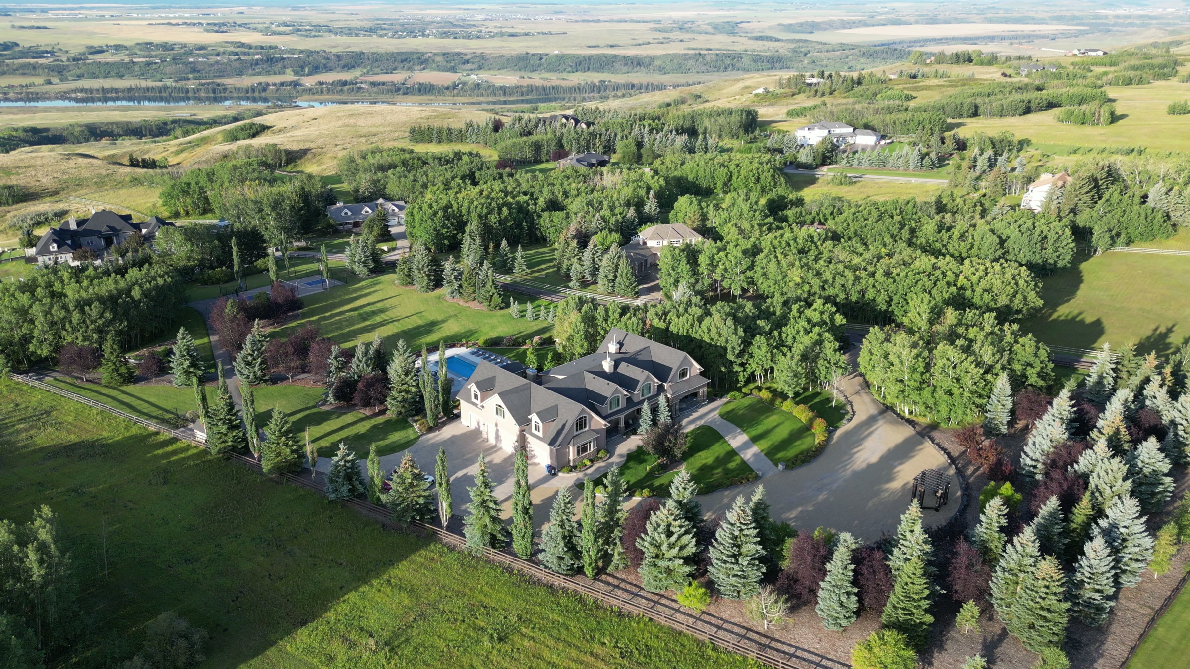
Film, photography and aerial cinematography for the homes, businesses and places that define Kings Heights. Level east-side prairie carrying a planned community's geometry — crescents and closes stepped off a straight boulevard spine, with open grain land beginning again at the eastern edge.
Does Atom2Adam work in Kings Heights?
Yes. Atom2Adam makes film, photography and aerial cinematography in Kings Heights, Alberta — for homes, businesses and brands. For aerial work the airspace is Mixed — control zone edge and local aerodrome. Aerial work here flies under an Advanced RPAS certificate, and the airspace authorisation is filed before any shoot date is confirmed. Typical mobilisation from the Calgary studio is 30 minutes.
Kings Heights at a glance
| Studio | Calgary, Alberta |
|---|---|
| Drive from the studio | 30 minutes |
| Airspace | Mixed — control zone edge and local aerodrome |
| Nearest aerodrome | Airdrie aerodrome |
| Aerial authorisation | Yes — filed before the date is confirmed |
| Aerial status | Flown under airspace authorisation |
| Certification | Transport Canada RPAS — Advanced Operations |
| Response | We reply within one business day |
| Airspace record derived | 2026-09-01 |
Working in Kings Heights.
Kings Heights was built in one sustained push, and it shows from altitude — rooflines run to a consistent height and pitch, fencing is uniform, and the crescents coil off Kingsview Boulevard SE in a single unbroken pattern. That consistency is what buyers like about the community and what makes an individual listing disappear — from a standard high oblique, one address looks like fifty others.
The answer is altitude discipline: a lower, closer orbit keeps the home dominant in frame while one locator — Kingsview Market or the boulevard — holds the edge of the shot, delivered on the turnaround agreed at booking.
Light. New-build streetscapes photograph best under low, raking light, and the open horizons give that at both ends of the day in spring and autumn. Fresh snow simplifies the rooflines into strong graphic pattern; mid-summer midday flattens everything.
Terrain. Level east-side prairie carrying a planned community's geometry — crescents and closes stepped off a straight boulevard spine, with open grain land beginning again at the eastern edge.
Wind. Exposed chinook-belt prairie. Nothing on Airdrie's east side breaks the wind, and gusts that read as manageable in a treed Calgary neighbourhood arrive here at full strength.
Airspace. Kings Heights shares its airspace corridor with Airdrie, about 2 km away, and flights through it are planned as controlled airspace. An Advanced RPAS certificate covers the work, with NAV CANADA RPAS authorisation obtained wherever the specific site requires it. Every flight is preceded by a NAV Drone check of the specific site and altitude.
On the ground. Municipal parks, playgrounds and pathway land in Kings Heights fall under City of Airdrie rules for takeoff and landing, so launches stage from private property with the client's consent. About 30 minutes north of the Calgary base. Same-day is realistic, and Ravenswood next door can share the same mobilisation and the same light.
What we make for Kings Heights.
Every subject is approached the same way — creative direction, film, photography, aerial and post-production, scoped and quoted before anything is booked.
Kings Heights and what surrounds it.
- Film and photography in Ravenswood1 km · Mixed — control zone edge and local aerodrome
- Film and photography in Airdrie Downtown3 km · Mixed — control zone edge and local aerodrome
- Film and photography in Balzac8 km · Class C control zone (CYYC)
- Film and photography in Airdrie2 km · Mixed — control zone edge and local aerodrome
- Film and photography in Bayside3 km · Mixed — control zone edge and local aerodrome
How a Kings Heights shoot runs.
- 01Brief and scope. Kings Heights lends itself to new communities and show homes and luxury homes; the shot list follows the subject. Mobilisation is stated separately from the fee.
- 02Airspace, where the brief includes aerial work. Kings Heights sits under Airdrie aerodrome, 4 km away. Authorisation is filed with NAV CANADA and the date is confirmed once it is in hand.
- 03Light and weather. Exposed chinook-belt prairie. Nothing on Airdrie's east side breaks the wind, and gusts that read as manageable in a treed Calgary neighbourhood arrive here at full strength. New-build streetscapes photograph best under low, raking light, and the open horizons give that at both ends of the day in spring and autumn. Fresh snow simplifies the rooflines into strong graphic pattern; mid-summer midday flattens everything.
- 04Shoot day. About 30 minutes from the Calgary studio. Launch from the subject property with the owner's permission; municipal parks, playgrounds and pathway land in Kings Heights fall under City of Airdrie rules for takeoff and landing, so launches stage from private property with the client's consent.
- 05Post-production and delivery. Edited, graded and finished for every format it will live in, delivered digitally — which is how owners of Kings Heights property who live elsewhere can be served.
Kings Heights questions, answered.
How close is Kings Heights to the Airdrie aerodrome, and does it matter?
About 4 km — close enough that the corridor here is planned as controlled airspace. Flights in Kings Heights are conducted under an Advanced RPAS certificate, with a NAV CANADA RPAS authorisation obtained wherever the specific site requires one, and the site and altitude are confirmed against NAV Drone before every flight.
How do you make one Kings Heights home stand out from the air?
By flying closer and lower than the default. The community's rooflines and fencing are deliberately consistent, so a high wide frame turns a listing into pattern. A tighter orbit keeps the home large, then one locator — Kingsview Market, the boulevard or Genesis Place Recreation Centre — anchors where it sits.
Kings Heights is 1 km from Ravenswood.
Because mobilisation is quoted from the Calgary studio, Kings Heights and Ravenswood, 1 km away, carry different quotes for an identical subject.
Nearby
Airspace record derived from the published airspace geometry on . Rules change — the exact site is confirmed against NAV Drone before every flight.