High River, Alberta
Creative production in High River.
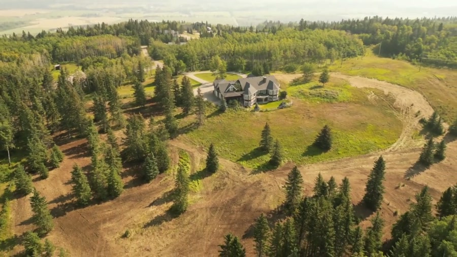
Film, photography and aerial cinematography for the homes, businesses and places that define High River. River floodplain and open ranch land. Very flat, with the Highwood River corridor as the defining feature.
Does Atom2Adam work in High River?
Yes. Atom2Adam makes film, photography and aerial cinematography in High River, Alberta — for homes, businesses and brands. For aerial work the airspace is Class G uncontrolled. No airspace authorisation is normally required. Typical mobilisation from the Calgary studio is 45 minutes.
High River at a glance
| Studio | Calgary, Alberta |
|---|---|
| Drive from the studio | 45 minutes |
| Airspace | Class G uncontrolled |
| Nearest aerodrome | High River aerodrome |
| Aerial authorisation | Not normally required |
| Aerial status | Standard RPAS rules apply |
| Certification | Transport Canada RPAS — Advanced Operations |
| Response | We reply within one business day |
| Airspace record derived | 2026-08-31 |
Working in High River.
High River sits on the Highwood River floodplain, and the 2013 flood rebuilt large parts of the town around new berms and drainage works. Flood mitigation is invisible from the street and highly visible from above, which matters to buyers, insurers and lenders assessing a property here.
A plan-view pass shows the property's actual relationship to the river and the mitigation works — the question a High River buyer is really asking.
Light. Long, open light. The river corridor is at its most legible after ice-off and before summer growth closes the banks in.
Terrain. River floodplain and open ranch land. Very flat, with the Highwood River corridor as the defining feature.
Wind. Southern foothills exposure. Strong, persistent west and southwest wind is normal rather than exceptional.
Airspace. High River sits in uncontrolled Class G airspace. The town aerodrome is close enough that its circuit is plotted on every local flight plan. This is a corridor-level assessment; the specific address is confirmed against NAV Drone (opens in a new tab) before every flight.
On the ground. Town of High River rules govern municipal land and the river pathway system. About 45 minutes south of the Calgary base. Comfortably same-day, though the wind window drives the timing more than the drive does.
What we make for High River.
- Farms and ranch land
- New communities and show homes
- Cafés, restaurants and retail
- Civic places and infrastructure
Every subject is approached the same way — creative direction, film, photography, aerial and post-production, scoped and quoted before anything is booked.
High River and what surrounds it.
- Film and photography in Okotoks18 km · Class G uncontrolled
- Film and photography in Aldersyde13 km · Class G uncontrolled, local aerodrome nearby
- Film and photography in Cayley14 km · Class G uncontrolled
- Film and photography in Nanton26 km · Class G uncontrolled
- Film and photography in Diamond Valley29 km · Class G uncontrolled
How a High River shoot runs.
- 01Brief and scope. High River lends itself to farms and ranch land and new communities and show homes; the shot list follows the subject. Mobilisation is stated separately from the fee.
- 02Airspace, where the brief includes aerial work. Checked against NAV Drone from the address, not the postcode. High River is class g uncontrolled, so authorisation is not normally required — but High River aerodrome is 3 km away and its circuit is plotted regardless.
- 03Light and weather. Southern foothills exposure. Strong, persistent west and southwest wind is normal rather than exceptional. Long, open light. The river corridor is at its most legible after ice-off and before summer growth closes the banks in.
- 04Shoot day. About 45 minutes from the Calgary studio. Launch from the subject property with the owner's permission; town of High River rules govern municipal land and the river pathway system.
- 05Post-production and delivery. Edited, graded and finished for every format it will live in, delivered digitally — which is how owners of High River property who live elsewhere can be served.
High River questions, answered.
Can you fly a drone in High River?
Yes. High River sits in uncontrolled Class G airspace, so no NAV CANADA authorisation is normally required. The town aerodrome is close, so its circuit is plotted on the flight plan before every local shoot.
Why does flood context matter for High River aerial photography?
Because buyers, insurers and lenders all ask about it. A property's relationship to the Highwood River and to the mitigation works built after 2013 is invisible at street level and immediately clear in a plan view from altitude.
Is wind a problem for drone shoots in High River?
It is the main scheduling constraint. Southern foothills exposure means strong, persistent west and southwest wind is normal here, so a High River shoot is planned around a wind window rather than a calendar slot.
High River is 18 km from Okotoks.
Mobilisation is quoted from the Calgary studio, so a shoot in High River and one 18 km away in Okotoks are priced differently even when the subject is identical.
Nearby
Airspace record derived from the published airspace geometry on . Rules change — the exact site is confirmed against NAV Drone before every flight.