Penticton & the South Okanagan · British Columbia, Canada
Winery film and photography in Penticton and the South Okanagan.
Eight of the Okanagan Valley's eleven wine sub-appellations run from Summerland to the Golden Mile south of Oliver, and they face different ways: the Naramata Bench looks west across the lake, the Golden Mile Bench takes the morning. Atom2Adam takes winery, resort and vineyard-property commissions here, planned around that light and the harvest.

Does Atom2Adam work in Penticton and the South Okanagan?
Yes. Atom2Adam, a global creative consultancy and media agency operating from Calgary, takes commissions in Penticton, Naramata, Summerland, Okanagan Falls, Oliver and Osoyoos — for wineries, lake resorts, inns and vineyard property. It has no work in the South Okanagan yet; its nearest is aerial work at Westgate Cafe in Salmon Arm, 134 km north in a straight line. WestJet flies direct from Calgary to Penticton, and travel is billed at cost.
South Okanagan at a glance
| Agency | Global creative consultancy & media agency |
|---|---|
| Operating base | Calgary, Alberta, Canada |
| Communities | Penticton, Naramata, Summerland, Okanagan Falls, Oliver, Osoyoos |
| Nearest work | Westgate Cafe, Salmon Arm — 134 km north in a straight line |
| From Calgary | Direct WestJet flights to Penticton (YYF), or about 666 km by road |
| Wine sub-appellations | Eight, from Summerland to the Golden Mile (BC Wine Authority) |
| Aerial | Checked near Penticton, Oliver and Osoyoos airports; never across the US border |
| Coverage | British Columbia — routine for the studio |
| Response | We reply within one business day |
Every bench has its hour.
Penticton sits between Okanagan Lake and Skaha Lake, and the wine country runs out from it in both directions. Wine BC describes the Naramata Bench as west-facing vineyards on the quieter side of Okanagan Lake; the Golden Mile Bench, south of Oliver, gets the morning sun; the neighbouring Golden Mile Slopes sit in Mount Kobau's afternoon shade; the Skaha Bench lies on the lake's sunny eastern flank. For a camera that is a schedule: which estate is shot at breakfast and which at dusk.
Harvest moves with the vintage. Vancouver Magazine reports some producers picking as early as mid-August and others starting in October; icewine waits for temperatures below −8 °C, the legal threshold, and wineries declare their icewine plans by 31 October. Penticton's sunshine normals run from about 288 hours in July to 34 in December, so a winter brief is planned for mood rather than blue sky.
The trade is dense: Tourism Penticton counts more than 80 wineries within a 20-minute drive of the city, and Nk'Mip Cellars in Osoyoos, created by the Osoyoos Indian Band, describes itself as North America's first Indigenous-owned winery. Atom2Adam has not worked here yet. What follows is how a commission here is planned.
What wine country asks of a camera.
- 02Harvest and brand films. A winery film is a season compressed: pruning, the pick, the crush, the first pour. With picking that can start in mid-August or in October, it is scheduled with the winemaker rather than the calendar, and held on standby until the fruit is ready — brand and hospitality films.
- 03Bottles, rooms and tables. Tasting rooms, cellar doors, inn rooms and plates, photographed in the light each bench gives — a west-facing Naramata patio late in the day, a Golden Mile tasting room in the morning. See hospitality and product photography.
- 04Rows, frontage and estate lines. Vineyard rows, lake frontage and estate boundaries read from altitude. Flights near Penticton Regional Airport, the Oliver and Osoyoos airports, the bighorn range at Skaha Bluffs or the border line on Osoyoos Lake are planned site by site — aerial cinematography over vineyards and lakes.
- 01Choosing the bench. Eight sub-appellations means eight stories to choose between. The consultancy decides which bench, which hour and which season carry the brand, and which permissions — City, band, park — the shoot needs before anyone books a flight from Calgary. See how the consultancy and creative direction work.
- 05Graded to the label. In wine, colour is part of the brand. Edit, grade, sound and finishing at the studio keep a winery's look consistent from the harvest film to the bottle shot, delivered digitally for every channel it sells through — post-production, colour and sound.
Commissions the South Okanagan supports.
These follow the region's own economy — wine, lakes, fruit and Indigenous-owned tourism — not a list of past clients.
Estate wineries
Harvest films, vineyard aerials and cellar-door stills for estates on the Naramata, Skaha and Golden Mile benches.
Lake resorts and inns
Rooms, beaches and lake views on Okanagan, Skaha and Osoyoos lakes, scheduled around a regional hotel peak of 77% occupancy in July.
Vineyard and lakefront property
Estate parcels and waterfront homes, photographed and flown for sale, with boundaries and frontage shown from above.
Indigenous-owned tourism
Brand work for operators on band land, made with the Penticton Indian Band's or the Osoyoos Indian Band's permission — never around it.
Fruit and farm brands
Orchards and harvest in a city that has held a peach festival since 1947.
Events
Peachfest week in Penticton — from the Wednesday after the BC Day long weekend to the Sunday — and harvest-season tastings, filmed with the organisers.
The nearest work, named as such.
Atom2Adam has no work in the South Okanagan. These frames come from Westgate Cafe in Salmon Arm, 134 km north, and from Radium Hot Springs, 281 km north-east — shown for the craft, each captioned with its own place.
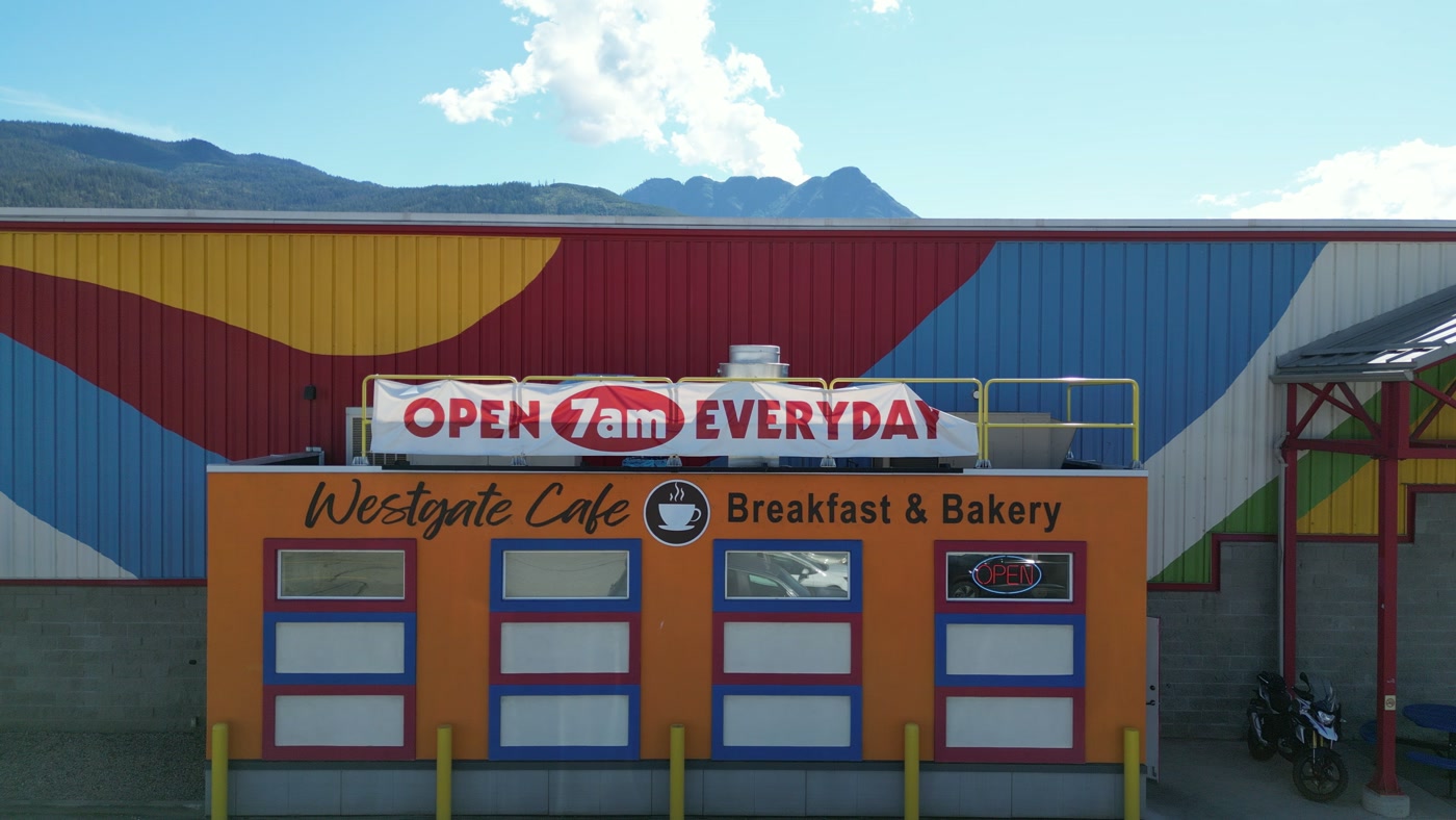
A café held head-on: the rooftop banner, the name and painted cup, four framed windows.Westgate Cafe, Salmon Arm, British Columbia — 134 km north of Penticton & the South Okanagan in a straight line, from the studio's work. 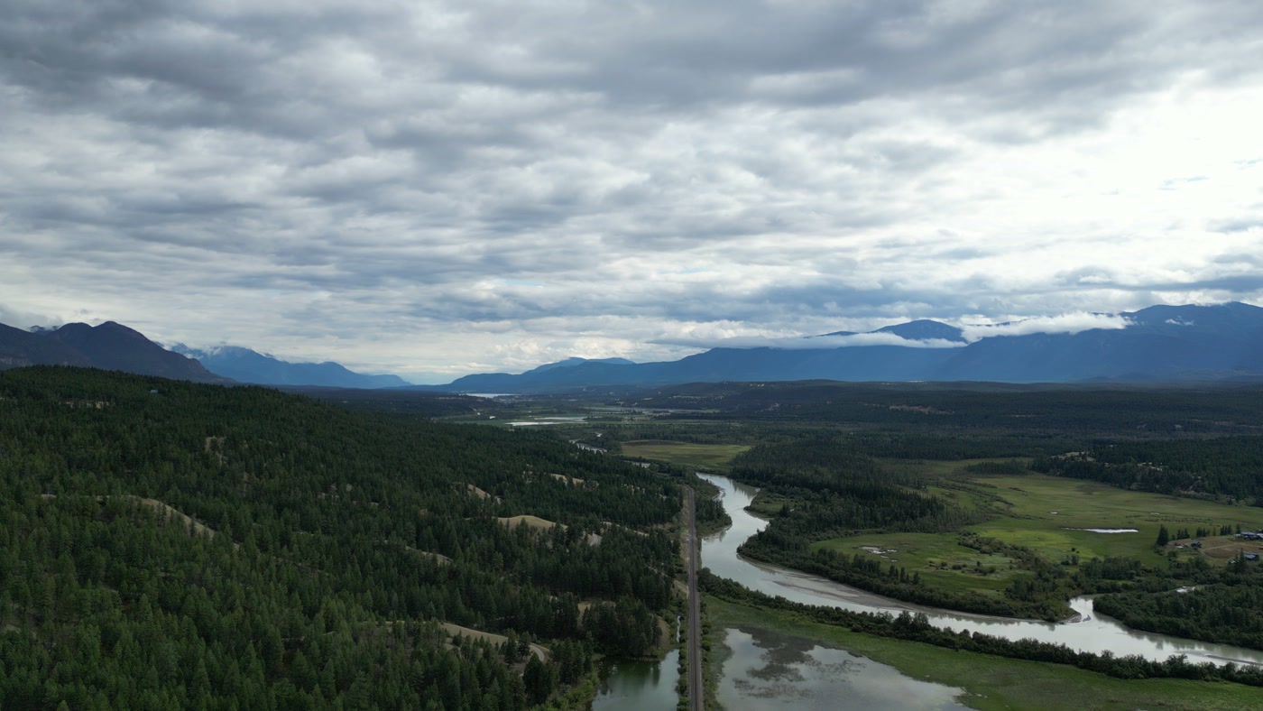
Down a valley from above a forested slope: river, rail line and fields running toward the far ranges.Fields and Forest, Radium Hot Springs, British Columbia — 281 km north-east of Penticton & the South Okanagan in a straight line, from the studio's work. 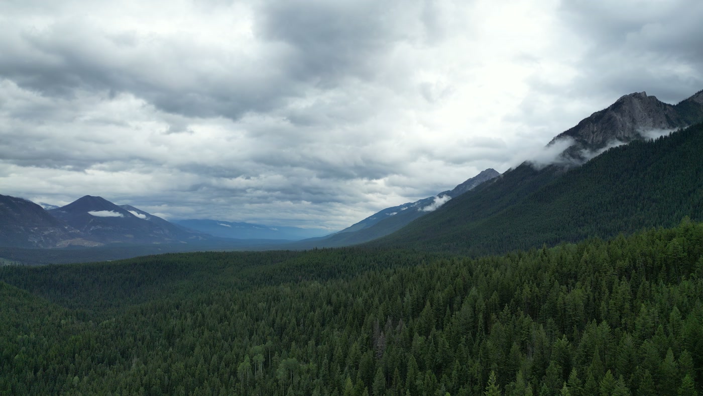
Dense canopy on a valley wall, running unbroken to a low ridge under heavy overcast.Mountain and Forest, Radium Hot Springs, British Columbia — 281 km north-east of Penticton & the South Okanagan in a straight line, from the studio's work.


A sign, head on.
Nearly twenty seconds from the Westgate Cafe story, made in Salmon Arm, 134 km north: easing in head-on toward a café front at half speed — the name in black script, a painted cup, four framed windows and the banner above. The same slow approach puts a winery's name, a tasting room or an inn's door at the centre of its own film.

Planning a South Okanagan shoot.
Getting there. WestJet flies direct from Calgary to Penticton Regional Airport, and Kelowna International is about 1.5 hours' drive away (Tourism Penticton). By road it is about 666 km from Calgary, across mountain passes where British Columbia's winter tire and chain rules apply from 1 October to 30 April.
Light and season. Daylight in Penticton runs 16 h 17 min on 21 June and 8 h 09 min on 21 December (US Naval Observatory). July is the region's busiest hotel month; Peachfest fills Penticton's waterfront in early August; harvest runs from mid-August into October.
Airspace. Penticton Regional Airport lies 3.3 km south-west of the city, and the Oliver and Osoyoos airports are each within walking distance of their downtowns. Airspace is confirmed for each site against NAV CANADA and Transport Canada's rules before a date is confirmed. Osoyoos is 3.6 km north of the US border, and no flight crosses it.
Fire. Flying a drone within 9.3 km of a wildfire is illegal, with fines up to $15,000 for a corporation (Transport Canada, July 2026). The BC Wildfire Service's 2025 summary concluded that the traditional core wildfire season is a thing of the past, so harvest-season aerial work keeps a second date.
Parks and wildlife. Skaha Bluffs Provincial Park holds critical range for bighorn rams. BC Parks filming starts with regional park staff and an application through FrontCounter BC, and may need First Nations engagement. Vaseux-Bighorn National Wildlife Area is day-use only, and the South Okanagan–Similkameen national park reserve is still being negotiated.
Permits and land. The City of Penticton asks for film-permit applications at least 14 days ahead and requires further approvals for drones. The Penticton Indian Band asks to be informed through its Lands Department before work on reserve land, and the Osoyoos Indian Band, which owns more than 32,000 acres, grants its own permission. Spotted Lake (kɬlilxʷ) is a sacred site, viewed only from outside its fence.
Questions about Penticton & the South Okanagan, answered.
Has Atom2Adam worked in the South Okanagan?
Not yet. Atom2Adam's nearest published work is aerial film and photography at Westgate Cafe in Salmon Arm, 134 km north in a straight line, and two aerial stories at Radium Hot Springs, 281 km north-east. They are shown here for the craft, labelled with their own places. The studio takes commissions in the South Okanagan; it has no local office or crew.
When should a winery book a harvest film?
Early, and loosely. Okanagan picking can start in mid-August for some producers and in October for others, and icewine waits for −8 °C and must be declared by 31 October. The film is scheduled with the winemaker, with standby days, rather than fixed months ahead to a date the fruit will not keep.
Can a drone fly over Osoyoos Lake?
Only over the Canadian side. Osoyoos Lake is shared with Washington State, and Osoyoos sits 3.6 km north of the border, so any aerial plan stays north of the line. Osoyoos Municipal Airport is within walking distance of the downtown core, and every site is checked against its airspace before a shoot date is confirmed.
Do we need permission to film on band land?
Yes. The Penticton Indian Band asks visitors to inform its Lands Department before entering reserve land to work, and the Osoyoos Indian Band's land and businesses need its own agreement. A shoot is scoped with that permission in hand — it is never planned around the band, and its timing follows the band's answer.
Is the South Okanagan national park open?
No. The South Okanagan–Similkameen national park reserve is a proposal: a memorandum of understanding was signed in 2019, and Parks Canada's 2025–26 plan lists the establishment agreement as still to be negotiated. Provincial rules apply on that land today, including BC Parks permits in the South Okanagan Grasslands Protected Area.
How is a Penticton commission quoted?
By the commission, against a written brief: creative direction, shoot days and post-production make up the fee; flights from Calgary, accommodation, ground transport and local permits are billed at cost. No rates are published, because a harvest film, a resort campaign and a vineyard listing set are different pieces of work.
Around Penticton & the South Okanagan.
Other destinations
From the Calgary base
Where the facts on this page come from
- Wine BC — Okanagan Valley (opens in a new tab)Which way each bench faces.
- BC Wine Authority — Wine regions (opens in a new tab)The Okanagan's sub-appellations.
- Wikipedia — Penticton (opens in a new tab)The city between two lakes, and its sunshine normals.
- Vancouver Magazine — The Wine List: 3 Okanagan wines, 3 unique harvest stages (opens in a new tab)Harvest timing.
- Country Life in BC — Icewine harvest begins (opens in a new tab)The −8 °C threshold and the 31 October declaration.
- Tourism Penticton — Wine (opens in a new tab)Wineries within a 20-minute drive.
- Nk'Mip Cellars (opens in a new tab)The winery's own description.
- Tourism Penticton — Getting here (opens in a new tab)Direct WestJet flights from Calgary.
- Rome2Rio — Calgary to Penticton (opens in a new tab)Road distance.
- U.S. Naval Observatory — Duration of daylight, Penticton (opens in a new tab)Solstice day lengths.
- Destination BC — Thompson Okanagan regional tourism profile (PDF, 2026) (opens in a new tab)Hotel occupancy by month.
- Penticton Peach Festival (opens in a new tab)Festival timing since 1947.
- Wikipedia — Penticton Regional Airport (opens in a new tab)The airport's distance from the city.
- Wikipedia — Osoyoos (opens in a new tab)Distance to the US border.
- Transport Canada — Flying a drone near wildfires is illegal and dangerous (July 2026) (opens in a new tab)The 9.3 km rule and its penalties.
- BC Parks — Skaha Bluffs Park (opens in a new tab)Bighorn ram range.
- Parks Canada — 2025 to 2026 Departmental Plan (opens in a new tab)The national park reserve's status.
- City of Penticton — Filming (opens in a new tab)Film-permit lead time and drone approvals.
- Penticton Indian Band — Lands Department (opens in a new tab)Notice before work on reserve land.
- Osoyoos Indian Band — Businesses (opens in a new tab)The band's land holdings.
Checked against these sources on . Access, permits and airspace change, so each is confirmed again for the specific site when a commission is scoped.