Drumheller, Alberta
Filming the badlands around Drumheller.
Atom2Adam, a global creative consultancy and media agency operating from Calgary, takes commissions in Drumheller: destination and brand films in the Red Deer River badlands, photography for its hotels and attractions, and aerial cinematography planned around the Town's drone policy, a restricted area south-east of town and the provincial park at the Royal Tyrrell Museum.
From the work

No published project is placed in Drumheller; this film and the frames below are shown for the briefs its commissions bring — a valley read from its rim at dusk, first light on open country, people in big landscape.
Does Atom2Adam work in Drumheller?
Yes. Atom2Adam, a global creative consultancy and media agency whose operating base is Calgary, makes film, photography and aerial cinematography in Drumheller, Alberta — for homes, businesses and brands. For aerial work the airspace is Class G uncontrolled, with a restricted area south-east of town. This airspace does not normally require an authorisation. From the Calgary base, mobilisation is typically 1.9 hours.
Half a million museum visitors, and a valley that doubles for other worlds.
Tourism is Drumheller's main industry. The Royal Tyrrell Museum of Palaeontology recorded 566,656 visitors in 2025, an all-time high, Kneehill County counts hundreds of thousands a year at Horseshoe Canyon, and Travel Drumheller, the region's destination-marketing organisation, lists eight hotels and motels and posts calls for creative proposals. Destination films, attraction campaigns and hospitality photography are the commissions this visitor economy runs on.
The Drumheller valley has long worked as a film set. The Town of Drumheller says it doubles for the American West, apocalyptic landscapes, other planets and the Middle East, lists productions including The Revenant, Fargo, Ghostbusters: Afterlife and The Last of Us, and offers a no-fee film permit to keep them coming. For a brand, an automotive campaign or a music video, the badlands are a backdrop within two hours of Calgary.
Drumheller's coal-mining past is still on the ground: the Atlas Coal Mine National Historic Site in East Coulee preserves the last wooden tipple in Canada, the Star Mine Suspension Bridge crosses the Red Deer River at Rosedale, and the road to Wayne crosses the Rosebud River 11 times in six kilometres. The 86 ft World's Largest Dinosaur stands downtown, and the 2,500-seat Badlands Amphitheatre stages concerts, opera and the Passion Play.
Drumheller, discipline by discipline.
- 01
Film
Destination and brand films for Drumheller's attractions, tourism operators and productions that want the badlands as a backdrop.
- 02
Aerial
Aerial cinematography of the valley launched from private land in Class G airspace, with the Town's application where municipal property is used and the restricted area south-east of town kept out of every flight plan.
- 03
Photography
Photography for the valley's hotels, short-term rentals, breweries and attractions — interiors in the hard midday light, exteriors at dawn and dusk.
- 04
Consultancy & Creative Direction
Briefs that sequence the permits a badlands shoot stacks up — the Town, Alberta Parks, the Royal Tyrrell Museum and the Atlas Coal Mine — before a date is set.
- 05
Post-Production
Colour and sound finished for destination campaigns, brand films and the social cuts a tourism season needs, delivered wherever the client is.
Drumheller at a glance
| Agency | Global creative consultancy & media agency |
|---|---|
| Operating base | Calgary, Alberta, Canada |
| Drive from the base | 1.9 hours |
| Airspace | Class G uncontrolled, with a restricted area south-east of town |
| Nearest aerodrome | Drumheller Municipal Airport (CEG4) |
| Aerial authorisation | Not normally required |
| Aerial status | Standard RPAS rules apply |
| Certification | Transport Canada RPAS — Advanced Operations |
| Response | We reply within one business day |
| Airspace record derived | 2026-10-05 |
Working in Drumheller.
The Town of Drumheller caps drone flights over its own property at the height of its airport runway — about 122 m above the Red Deer River, which is roughly how deep the badlands cut below the prairie. A badlands shot planned from a map can climb into that ceiling over municipal land, fall inside the 100 ft buffer the Town keeps around people, vehicles and buildings, or drift toward the restricted circle south-east of town.
Launch points are chosen on private land with the owner's consent, the Town's application is filed wherever municipal property is used, and the restricted circle is plotted out of every flight plan before NAV Drone confirms the site.
Light. A 21 June day runs from about 5:14 to 21:52, nearly 16.6 hours of daylight, so a dawn-and-dusk brief means an overnight, while 21 December holds about 7.8 hours. July highs average 26.3 °C with 17 days a year above 30 °C, and Kneehill County warns that Horseshoe Canyon can be very hot and dry, so the hardest light is kept for interiors. June is the wettest month at 74.0 mm, and the river's annual peak flows usually arrive between mid-May and mid-July.
Terrain. Drumheller's stretch of the Red Deer River valley runs about 28 km long and 2 km wide, cut roughly 120 m below the prairie bench. The 1998 amalgamation made Drumheller Alberta's largest town by land area, 107.93 km² strung along the valley from Nacmine to East Coulee. Between Rosedale and Wayne the road crosses 11 one-lane bridges in six kilometres over the winding Rosebud River.
Wind. Environment and Climate Change Canada's 1991–2020 normals from the valley-floor station at Drumheller East put the mean wind at a gentle 9.2 km/h, most often from the south-east in every month as the valley steers it, and strongest in April and May (11.4–11.6 km/h). Conditions on the prairie rim and the canyon tops may differ, and afternoon humidity falls to about 35–39% in summer, so dust and static are planned for.
Airspace. Drumheller sits in uncontrolled Class G airspace on the published geometry: the nearest control zone, around Calgary International, ends about 85 km away, so no NAV CANADA authorisation is normally required. Two constraints shape every flight instead: CYR211, a continuously active Class F restricted area of one nautical mile around the Drumheller Institution whose edge lies about 2.9 km south-south-east of the town centre, and the health centre heliport about 0.84 km from downtown, flown as an Advanced operation that yields to air ambulances. The specific site is confirmed against NAV Drone before every flight.
On the ground. Under Council Policy C-07-19 the Town of Drumheller allows only commercial drone use on municipal property, after an approved application with an Advanced certificate, a flight plan and $2 million in insurance naming the Town, and filming on streets or municipal property needs its no-fee Film Permit, filed seven business days ahead or 14 with closures. The working default is to launch from the client's own property with consent. About 111 minutes and 137 km north-east of the Calgary base by Deerfoot Trail, Highway 566 and Highway 9, so a single shoot day is a day trip. Briefs that want both dawn and dusk on the badlands are booked with an overnight, and Rosebud, about 30 km south, sits on the same drive.
The commissions Drumheller calls for.
Destination campaign film
A film for a tourism operator or the region's destination marketers that follows the visitor's day — the museum, the hoodoos, the Bleriot Ferry — under each site's own approvals.
Badlands backdrop shoots
Brand, automotive or music-video work in the valley the Town markets as a stand-in for other places, arranged on private land or under the Town's permits.
Hotel and rental photography
Photography for the valley's hotels and for short-term rentals, which have needed a Town business licence since February 2024.
Destination weddings
Film and photography for weddings at the Badlands Community Facility, which the Town markets for ceremonies beside the Red Deer River.
Frames from the work
None of these frames comes from a project placed in Drumheller; each caption says where its frame was made.
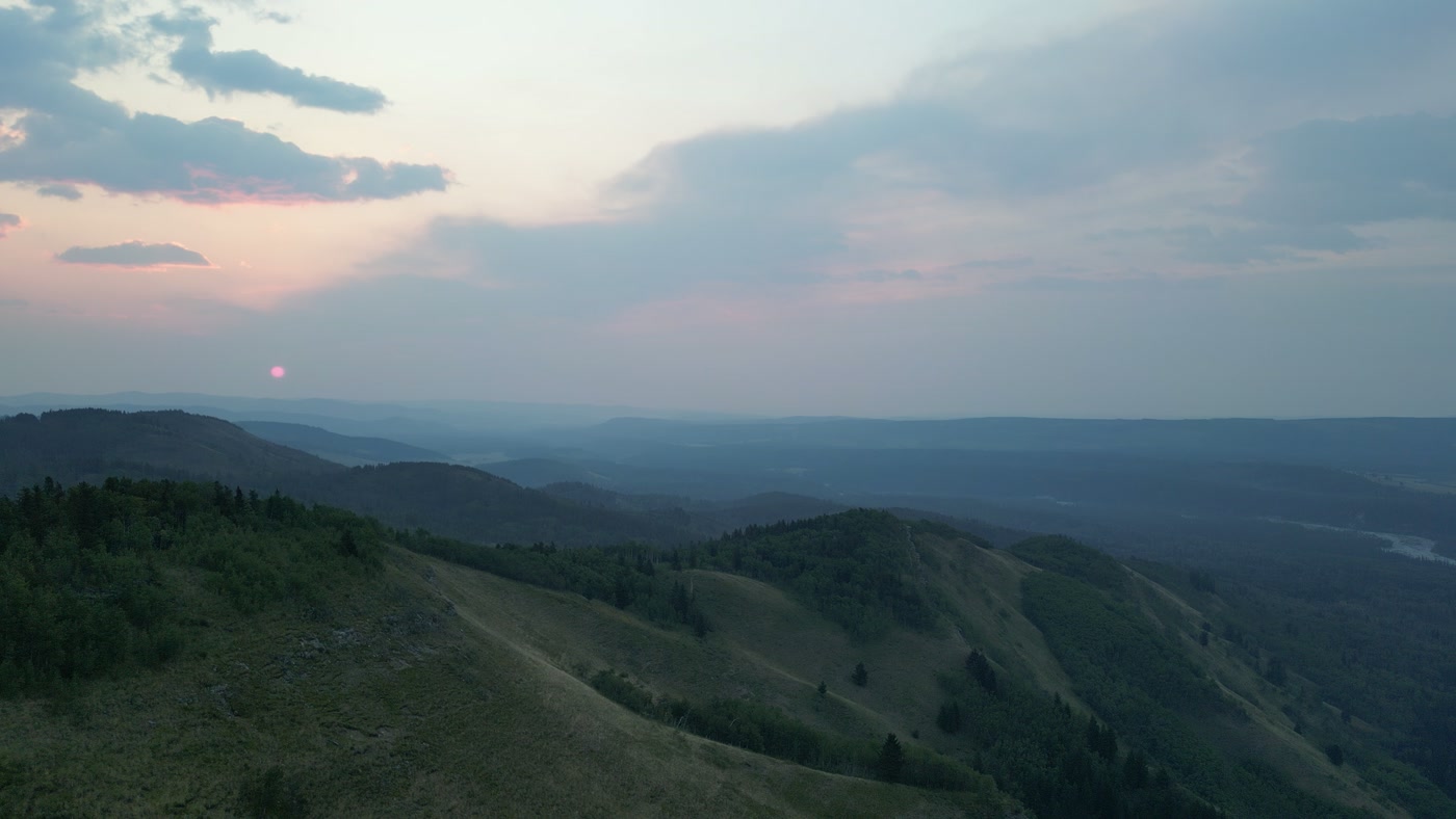
The sun just clear of the last ridge at sunrise, a pink-red disc in the haze. Made in Alberta foothills.Sunrise Hike 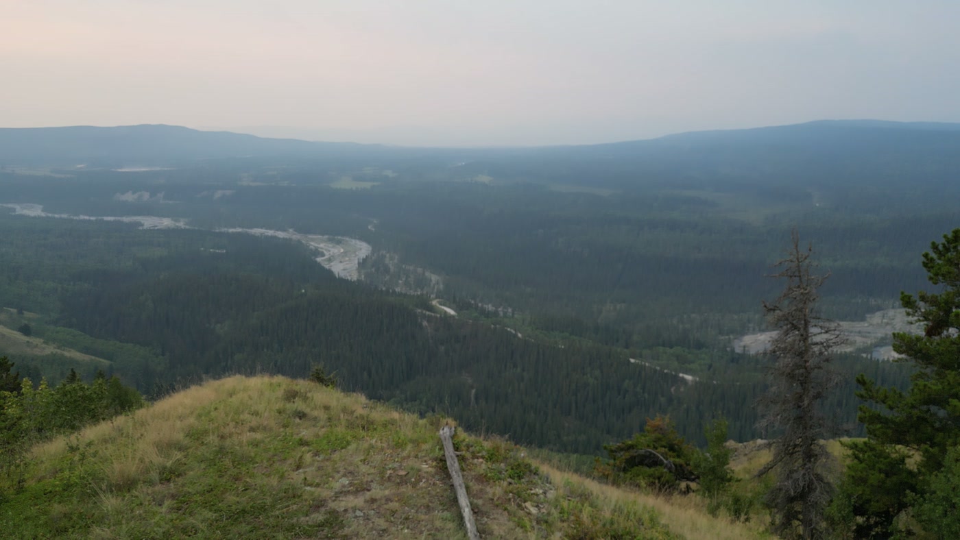
Five hikers gathered on a grass summit, seen from straight above. Made in Alberta foothills.Sunrise Hike 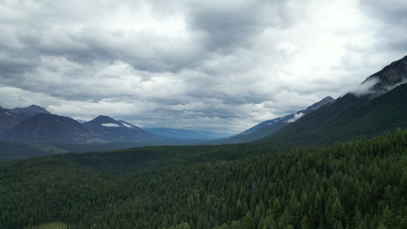
A wide trench opening beyond a conifer canopy, ridges falling away under cloud. Made in Radium Hot Springs, British Columbia.Mountain and Forest


What we make for Drumheller.
Every subject is approached the same way — creative direction, film, photography, aerial and post-production, scoped and quoted before anything is booked.
Drumheller and what surrounds it.
- Film and photography in Rosebud30 km · Class G uncontrolled
- Film and photography in Hussar42 km · Class G uncontrolled
- Film and photography in Standard43 km · Class G uncontrolled
- Film and photography in Kathyrn62 km · Class G uncontrolled
- Film and photography in Strathmore67 km · Class G uncontrolled
Named in Drumheller
Royal Tyrrell MuseumMidland Provincial ParkWorld's Largest DinosaurWillow Creek HoodoosAtlas Coal Mine National Historic SiteStar Mine Suspension Bridge11 Bridges to WayneHorseshoe CanyonBadlands AmphitheatreBleriot Ferry
How a Drumheller shoot runs.
- 01Brief and scope. Drumheller lends itself to hospitality and tourism and brand and campaign films; the shot list follows the subject. Mobilisation is stated separately from the fee.
- 02Airspace, where the brief includes aerial work. Checked against NAV Drone from the address, not the postcode. Drumheller is class g uncontrolled, with a restricted area south-east of town, so authorisation is not normally required — but Drumheller Municipal Airport (CEG4) is 4.1 km away and its circuit is plotted regardless.
- 03Light and weather. Environment and Climate Change Canada's 1991–2020 normals from the valley-floor station at Drumheller East put the mean wind at a gentle 9.2 km/h, most often from the south-east in every month as the valley steers it, and strongest in April and May (11.4–11.6 km/h). Conditions on the prairie rim and the canyon tops may differ, and afternoon humidity falls to about 35–39% in summer, so dust and static are planned for. A 21 June day runs from about 5:14 to 21:52, nearly 16.6 hours of daylight, so a dawn-and-dusk brief means an overnight, while 21 December holds about 7.8 hours. July highs average 26.3 °C with 17 days a year above 30 °C, and Kneehill County warns that Horseshoe Canyon can be very hot and dry, so the hardest light is kept for interiors. June is the wettest month at 74.0 mm, and the river's annual peak flows usually arrive between mid-May and mid-July.
- 04Shoot day. About 1.9 hours from the Calgary base. Launch from the subject property with the owner's permission; under Council Policy C-07-19 the Town of Drumheller allows only commercial drone use on municipal property, after an approved application with an Advanced certificate, a flight plan and $2 million in insurance naming the Town, and filming on streets or municipal property needs its no-fee Film Permit, filed seven business days ahead or 14 with closures. The working default is to launch from the client's own property with consent.
- 05Post-production and delivery. Edited, graded and finished for every format and market it will live in, delivered digitally — which is how owners of Drumheller property who live elsewhere, anywhere in the world, are served by a global agency.
Drumheller questions, answered.
Why can't a drone cross the circle south-east of downtown Drumheller?
Because it is restricted airspace. CYR211, a Class F restricted area one nautical mile in radius around the Drumheller Institution, runs from the surface to 3,800 ft ASL continuously, its nearest edge about 2.9 km from the town centre, and no aircraft — a drone under 250 g included — enters it without the Warden's authorisation. Every Drumheller flight plan is drawn with the circle plotted out of it, and the Town also circulates each drone application to the institution.
Can aerial footage include the Royal Tyrrell Museum or the hoodoos?
Only with permits arranged well ahead. The museum stands in Midland Provincial Park, where Alberta Parks bans recreational drones and allows commercial take-off only through an approved filming permit application, and the museum's own filming requests take a three-to-six-week Government of Alberta review. The Willow Creek Hoodoos are a Provincial Historic Resource with no published drone rule, so launch permission there is confirmed before the shoot, and the airspace over both sites is Class G.
What does the Town of Drumheller require before a drone takes off from a street, park or parking lot?
An approved application. Under Council Policy C-07-19 the Town allows only commercial drone use on municipal property, after an application with a Transport Canada Advanced certificate, a site map and flight plan, and $2 million in insurance naming the Town; on site, take-off is from a secured 200 ft area and flights stay 100 ft from people, vehicles and buildings. The Town charges no application fee and circulates each application to the aerodrome, the Drumheller Institution and emergency services.
Our production company is outside Alberta — can the badlands stand in for somewhere else, and what permits apply?
Yes, by the Town's account. The Town of Drumheller says the valley doubles as the American West, apocalyptic landscapes, other planets and the Middle East, and offers a no-fee film permit for streets and municipal property, filed seven business days ahead or 14 with closures; filming on private property is arranged with the owner and needs no Town film permit. The Town lists The Revenant, Fargo, Ghostbusters: Afterlife and Prey among the productions that have used the valley.
Can you film at the Atlas Coal Mine or Horseshoe Canyon?
Yes, on the owners' terms. The Atlas Coal Mine National Historic Site bans drones outright and arranges film and photo use in writing, months ahead and for a charge, while Horseshoe Canyon is owned in part by Kneehill County and the Nature Conservancy of Canada, which publish no drone rule, so the county is asked first. Horsethief Canyon is a viewpoint only: the canyon itself is private property.
Drumheller is 30 km from Rosebud.
Every quote starts at the Calgary base, which is why identical subjects in Drumheller and Rosebud — 30 km apart — price differently.
Nearby
Airspace record derived from the published airspace geometry on . Rules change — the exact site is confirmed against NAV Drone before every flight.