Maple Creek, Saskatchewan
Maple Creek, where the hills meet the plain.
Atom2Adam, a global creative consultancy and media agency operating from Calgary, takes commissions in Maple Creek — four hours from its base — for photography, film and aerial work across the town's heritage district, its ranches and the Saskatchewan side of the Cypress Hills.
From the work

No published project is placed in Maple Creek; the estate film and the ranch, small-town and ridge frames are the studio's closest analogues to the ranch country and heritage streets around it.
Does Atom2Adam work in Maple Creek?
Yes. Atom2Adam, a global consultancy and media agency that operates from Calgary, makes film, photography and aerial cinematography in Maple Creek, Saskatchewan — for homes, businesses and brands. For aerial work the airspace is Class G uncontrolled. This airspace does not normally require an authorisation. From the Calgary base, mobilisation is typically 4 hours.
Saskatchewan's highest ground starts at the edge of town.
Maple Creek sits on the east side of its creek, where the north slope of the Cypress Hills meets the flat plain. Within 35 km the land climbs from below 800 m to more than 1,200 m, and the hills hold Saskatchewan's highest point and the only naturally occurring lodgepole pine forest on the Canadian prairies. A Maple Creek commission can move from main street to forest in under an hour.
Maple Creek's main street is the subject in town: Council designated the downtown a Heritage District, and the town won the Prince of Wales Prize for municipal heritage leadership in 2019. The 1910 Union Bank building, St. Mary's orange-brick church and the 1935 log museum stand within a few blocks of Jasper Street, while east of town the Cowtown Livestock Exchange and the High Chaparral Arena carry the ranching economy.
Cypress Hills Interprovincial Park, about 30 km south of Maple Creek by road, was designated a dark-sky preserve in 2004, and the Resort at Cypress Hills there stays open year-round. ECCC's Cypress Hills station records a July mean of 15.9 °C against 19.9 °C at Maple Creek North — the hills make their own weather, and the shoot is planned around it.
Maple Creek, discipline by discipline.
- 01
Photography
Photography for a heritage main street and the ranches around it — the 1910 Union Bank building, St. Mary's orange brick, a working corral at golden hour — composed so nothing in the frame is accidental.
- 02
Film
Films for ranches, the resort in the hills and the rodeo grounds, planned with the plateau early in the day and the town in the evening light.
- 03
Aerial
Aerial work in uncontrolled airspace over town and ranch land, with CYR316, the airport's circuits and Parks Canada's no-drone sites plotted first, and any flight in the park cleared in writing.
- 04
Consultancy & Creative Direction
Creative direction for Maple Creek businesses and destinations, from the shot list for a ranch listing to a campaign for the hills, agreed by call before the four-hour drive east.
- 05
Post-Production
Editing, colour and sound that keep dry prairie light and lodgepole-pine shade in one grade, with cuts for listings, social channels and booking pages.
Maple Creek at a glance
| Agency | Global creative consultancy & media agency |
|---|---|
| Operating base | Calgary, Alberta, Canada |
| Drive from the base | 4 hours |
| Airspace | Class G uncontrolled |
| Nearest aerodrome | Maple Creek Airport (CJQ4) |
| Aerial authorisation | Not normally required |
| Aerial status | Standard RPAS rules apply |
| Certification | Transport Canada RPAS — Advanced Operations |
| Response | We reply within one business day |
| Airspace record derived | 2026-10-06 |
Working in Maple Creek.
Maple Creek sits where the north slope of the Cypress Hills meets the flat plain, and within 35 km the land climbs from below 800 m to more than 1,200 m — the hills hold Saskatchewan's highest point. The weather splits with the height: ECCC's Cypress Hills station records 21.8 thunderstorm days a year against 6.3 at Maple Creek North, so a clear morning in town is no promise of a clear afternoon on the plateau.
A Maple Creek commission puts the plateau work early in the day and the town and ranch frames in the evening light, with a weather day held in reserve.
Light. ECCC's 1981–2010 normals at Maple Creek North give a January mean of −8.5 °C and a July mean of 19.9 °C, with 388 mm of precipitation a year and June the wettest month. On the June solstice the sun sets at 21:30 and civil twilight lasts until 22:15, because Saskatchewan keeps Central Standard Time all year.
Terrain. The town sits at about 767 m on the east side of its creek, about 3 km upstream of Junction Reservoir, where the slope of the Cypress Hills gives way to the plain. The hills rise to Saskatchewan's highest point, 1,392 m, and carry the only naturally occurring lodgepole pine forest on the Canadian prairies, with fescue grassland around it.
Wind. Maple Creek has no wind normals of its own. The nearest stations disagree: Medicine Hat A, about 90 km west, averages 13.5 km/h, most often from the south-west, while Swift Current, about 135 km east, averages 20.3 km/h from the west — so the day's forecast, not a regional average, decides the aerial schedule.
Airspace. No control zone covers Maple Creek: the nearest published in NAV CANADA's Designated Airspace Handbook is Medicine Hat's, about 90 km west, so the town's low-level airspace reads as uncontrolled Class G — an inference from the published geometry that is confirmed for the exact site in NAV Drone before every flight. The Town's own airport, Maple Creek (CJQ4), sits about a kilometre from the town office and its circuits are plotted on every flight. Restricted area CYR316, 1 NM around the Okimaw Ohci Healing Lodge about 22 km south-east, from the surface to 5,000 ft, is closed without the warden's authorisation.
On the ground. The Town of Maple Creek publishes no film or drone bylaw; a visiting business needs a Town licence ($100 a day for non-local operators), and obstructing a street or sidewalk needs a permit under Bylaw No. 2003-MC-13. Fort Walsh and the Cypress Hills Massacre site are Parks Canada no-drone zones without a permit, and any flight in the park's Saskatchewan blocks is cleared in writing with the park office first. About 397 km from the Calgary base — roughly four hours east on the Trans-Canada and south on Hwy 21 — Maple Creek is the closest Saskatchewan market to the studio, and a one-night booking can cover a day in town and a day in the hills. There are no scheduled flights in the area, so the crew drives. Travel is billed at cost.
The commissions Maple Creek calls for.
Ranch and acreage properties
The Rural Municipality of Maple Creek covers 3,180 km² of ranch and farm land, and Historic Reesor Ranch became Saskatchewan's first ranch designated a Provincial Heritage Property in 2017. Listing photography and property films that show the land, the buildings and the hills behind them.
The heritage main street
Jasper Street's early-20th-century fronts hold a brewery taproom, cafés, museums and galleries, and the Town is inviting proposals to redevelop the Commercial Hotel. Photography and film for the businesses and buildings that keep the Heritage District working.
Resort, hospitality and weddings in the hills
The Resort at Cypress Hills holds weddings in every season, with a 250-seat Wapiti Room and a courtyard for ceremonies, and the park's Centre Block adds an observatory and Loch Leven. Wedding films, destination stills and night-sky sequences.
Rodeos and festivals
Showdown in Cowtown, the Maple Creek Ranch Rodeo, the July Heritage Festival and the Battle of the Little Big Puck fill the town's calendar. Event films from the ground, and from the air only with a Transport Canada SFOC for an advertised event.
Frames from the work
None of these frames comes from a project placed in Maple Creek; each caption says where its frame was made, or that the record does not say.
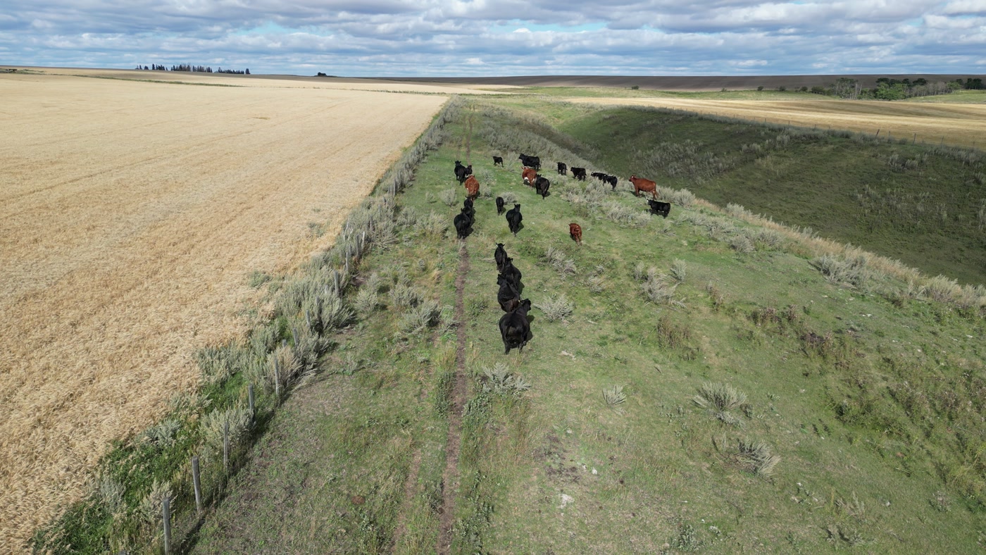
A herd of cattle strung out along a trail worn down a grassed draw between two fields. Where it was made is not recorded.Grain and Cattle 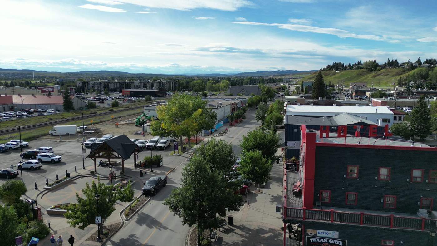
A small town's main street from above: the hotel block, the rail yard and hills on the horizon. Made in Cochrane, Alberta.MacKay's Ice Cream 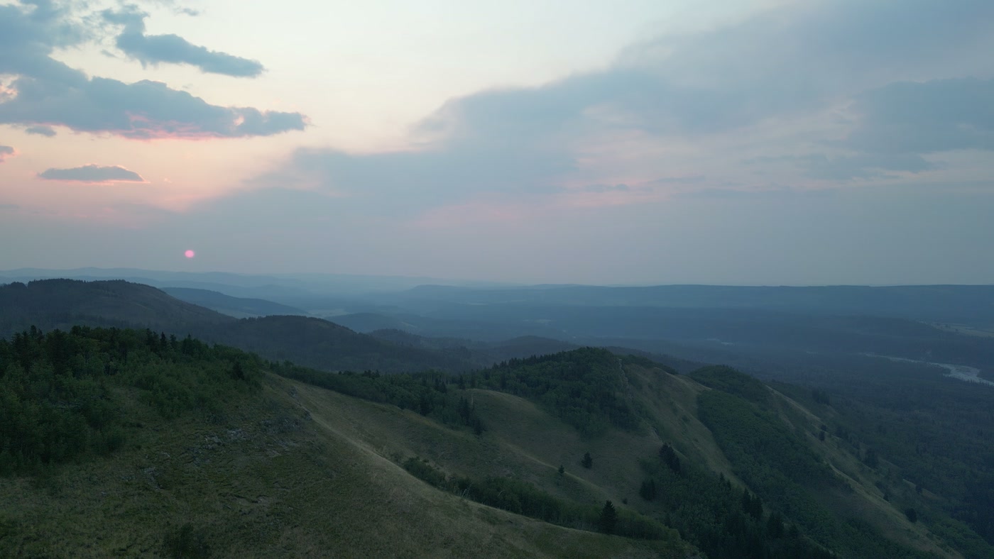
The sun just clear of the last ridge, layered forested ridges falling away below it. Made in Alberta foothills.Sunrise Hike


What we make for Maple Creek.
- Acreages and estates
- Farms and ranch land
- Hospitality and tourism
- Cafés, restaurants and shops
- Places and landmarks
Every subject is approached the same way — creative direction, film, photography, aerial and post-production, scoped and quoted before anything is booked.
Maple Creek and what surrounds it.
- Film and photography in Saskatoon316 km · Class C control zone (CYXE)
- Film and photography in Regina351 km · Class D control zone (CYQR)
- Film and photography in Prince Albert448 km · Class E control zone (CYPA)
- Film and photography in Yorkton516 km · Class E control zone (CYQV)
- Film and photography in Medicine Hat87 km · Class E control zone (CYXH) over nearly the whole city
Named in Maple Creek
Jasper StreetMaple Creek Heritage DistrictOrr Law Office (1910 Union Bank)St. Mary's Anglican ChurchJasper Cultural & Historical CentreS.W. Sask. Oldtimers' MuseumMaple Creek ArmouryHigh Chaparral ArenaCowtown Livestock ExchangeCypress Hills Interprovincial ParkFort Walsh National Historic SiteHistoric Reesor Ranch
How a Maple Creek shoot runs.
- 01Brief and scope. Maple Creek lends itself to acreages and estates and farms and ranch land; the shot list follows the subject. Mobilisation is stated separately from the fee.
- 02Airspace, where the brief includes aerial work. Checked against NAV Drone from the address, not the postcode. Maple Creek is class g uncontrolled, so authorisation is not normally required — but Maple Creek Airport (CJQ4) is 1 km away and its circuit is plotted regardless.
- 03Light and weather. Maple Creek has no wind normals of its own. The nearest stations disagree: Medicine Hat A, about 90 km west, averages 13.5 km/h, most often from the south-west, while Swift Current, about 135 km east, averages 20.3 km/h from the west — so the day's forecast, not a regional average, decides the aerial schedule. ECCC's 1981–2010 normals at Maple Creek North give a January mean of −8.5 °C and a July mean of 19.9 °C, with 388 mm of precipitation a year and June the wettest month. On the June solstice the sun sets at 21:30 and civil twilight lasts until 22:15, because Saskatchewan keeps Central Standard Time all year.
- 04Shoot day. About 4 hours from the Calgary base. Launch from the subject property with the owner's permission; the Town of Maple Creek publishes no film or drone bylaw; a visiting business needs a Town licence ($100 a day for non-local operators), and obstructing a street or sidewalk needs a permit under Bylaw No. 2003-MC-13. Fort Walsh and the Cypress Hills Massacre site are Parks Canada no-drone zones without a permit, and any flight in the park's Saskatchewan blocks is cleared in writing with the park office first.
- 05Post-production and delivery. Edited, graded and finished for every format and market it will live in, delivered digitally — which is how owners of Maple Creek property who live elsewhere, anywhere in the world, are served by a global agency.
Maple Creek questions, answered.
Is there restricted airspace near Maple Creek?
Yes, one area. Restricted area CYR316 is a 1 NM circle around the Okimaw Ohci Healing Lodge, about 22 km south-east of town, from the surface to 5,000 ft; no aircraft, drones included, may enter without the warden's authorisation. Over the town itself no control zone is published, and the exact site is confirmed in NAV Drone.
Can we fly a drone at Fort Walsh National Historic Site?
Not without a Parks Canada permit. Fort Walsh and the nearby Cypress Hills Massacre site are Parks Canada places, which are no-drone zones for recreation, and any commercial drone use has to be declared in a Film and Photography Permit application. Ground photography for a commission is planned with Parks Canada the same way.
Does a visiting crew need a Town of Maple Creek business licence?
Possibly. The Town's Business License Bylaw requires a licence to carry on business within town limits, and non-local operators pay $100 a day, $200 for six months or $400 a year. Whether a single commission counts is the Town's call, so Atom2Adam confirms it with the Town Office before the shoot.
Can the Cypress Hills be filmed at night?
From the ground, yes. Cypress Hills Interprovincial Park was designated a dark-sky preserve in 2004 and has an observatory, which makes night-sky and time-lapse work a natural part of a commission there. Any drone use in the park's Saskatchewan blocks is cleared in writing with the park office first, because Sask Parks publishes no drone rule.
Can an owner who lives elsewhere commission ranch photography near Maple Creek?
Yes. Atom2Adam agrees the brief, access and boundaries by call, photographs and films the property in the planned light, and delivers the finished, graded set digitally, so the owner does not need to be on site. Ranch roads and gates are confirmed with the owner beforehand.
Maple Creek is 316 km from Saskatoon.
Every quote starts at the Calgary base, which is why identical subjects in Maple Creek and Saskatoon — 316 km apart — price differently.
Nearby
Airspace record derived from the published airspace geometry on . Rules change — the exact site is confirmed against NAV Drone before every flight.