Medicine Hat, Alberta
Clay, river and industry: film in Medicine Hat.
Atom2Adam, a global creative consultancy and media agency operating from Calgary, takes commissions in Medicine Hat: films and photographs for its clay district, its river valley and its industries, with every aerial filed with NAV CANADA, because nearly the whole city sits inside the airport's control zone.
From the work

No published project is placed in Medicine Hat; this film and the frames below are shown for the subjects its commissions share — a working arts space, heritage craft, a maker's sign, a main street.
Does Atom2Adam work in Medicine Hat?
Yes. Atom2Adam, a creative consultancy and media agency, commissioned worldwide and operating from Calgary, makes film, photography and aerial cinematography in Medicine Hat, Alberta — for homes, businesses and brands. For aerial work the airspace is Class E control zone (CYXH) over nearly the whole city. Aerial work here flies under an Advanced RPAS certificate, and the airspace authorisation is filed before any shoot date is confirmed. From the Calgary base, mobilisation is typically 3.2 hours.
Gas built Medicine Hat, clay made its name, and the light does the rest.
Medicine Hat grew on natural gas and clay. The City's history records that Council began supplying every resident with gas in 1903, the start of the utility the City still owns, and Tourism Medicine Hat says the clay plants once shipped a third of all the ceramics sold across Canada. Medalta, a National Historic Site in a converted century-old factory, now runs a contemporary ceramic arts facility, a gallery and artist residencies in the 150-acre Historic Clay District — Medicine Hat's most filmable industrial heritage.
Medicine Hat's industry is still a brand-film subject. The City calls it Alberta's third largest petrochemical hub, home to Canada's only commercial-scale methanol facility, and says 44% of Alberta's greenhouse floor space lies within 20 minutes of downtown, growing tomatoes and cucumbers year-round. In 2025 the City took ownership of Saamis Solar, its plan for what it calls Canada's largest urban solar farm on a 1,600-acre brownfield in north Medicine Hat.
The city already works with crews. Its film office pitches Medicine Hat as Alberta's newest film-friendly city and counts nearly 100 designated historic buildings and locations, and Crowsnest Films shot three connectFirst Credit Union commercials there across 15 locations and 29 sets, from the Saamis Tepee to the trail system and downtown. Environment and Climate Change Canada's normals record 2,544 hours of bright sunshine a year in Medicine Hat — the light those locations are filmed in.
The work, in the order Medicine Hat needs it.
- 01
Film
Brand films for Medicine Hat's petrochemical plants, greenhouse growers and manufacturers, and heritage films for the Historic Clay District.
- 02
Photography
Photography of Medalta's kilns and galleries, the CPR-era brick of Historic Downtown and the 1908 steel truss of the Finlay Bridge.
- 03
Aerial
Aerial cinematography of the cutbanks and coulees under an Advanced RPAS certificate, filed through NAV Drone for every flight inside the CYXH zone and launched from private land, never a City park.
- 04
Consultancy & Creative Direction
Plans that book the long, dry July and August light, work around a parks bylaw with no designated launch sites yet, and keep Suffield's restricted airspace out of the shot list.
- 05
Post-Production
Edits, colour and sound finished for investor presentations, recruitment campaigns and tourism media, delivered wherever the client is based.
Medicine Hat at a glance
| Agency | Global creative consultancy & media agency |
|---|---|
| Operating base | Calgary, Alberta, Canada |
| Drive from the base | 3.2 hours |
| Airspace | Class E control zone (CYXH) over nearly the whole city |
| Nearest aerodrome | Medicine Hat Regional Airport (CYXH) |
| Aerial authorisation | Yes — filed before the date is confirmed |
| Aerial status | Flown under airspace authorisation |
| Certification | Transport Canada RPAS — Advanced Operations |
| Response | We reply within one business day |
| Airspace record derived | 2026-10-05 |
Working in Medicine Hat.
Medicine Hat brands itself Canada's Drone City, yet a drone flown in town gets no shortcut. Nearly every street sits inside the airport's control zone, and City parks have no designated launch site yet. A crew that takes the slogan at its word arrives without a NAV CANADA authorisation or a lawful launch point, and spends the morning light on the cutbanks on paperwork.
Every Medicine Hat flight is filed through NAV Drone before the date is confirmed and launched from private land with the owner's consent — never from a City park, boulevard or park sidewalk.
Light. Environment and Climate Change Canada's normals record 2,544 hours of bright sunshine a year and 330 days with measurable sunshine — the basis of the '330 days of sunshine' Tourism Medicine Hat promotes — with July at 353.5 hours, 71.7% of the possible daylight. A 21 June day runs from 05:13 to 21:36, the sunset about 19 minutes ahead of Calgary's, and July and August afternoons are dry, near 35–37% humidity. June is the wettest month at 65.4 mm, and January snow averages only 6 cm deep.
Terrain. The South Saskatchewan River valley shapes Medicine Hat, and Seven Persons Creek and Ross Creek join it inside the city, cutting cliffs and finger coulees through the neighbourhoods. North of downtown the cutbank rises about 50 m within roughly 0.7 km, from a valley floor near 660 m to benches above 700 m, and beyond the rim the short-grass prairie of Palliser's Triangle runs flat to slightly rolling. The City's Heritage Trail Network covers about 190 km and links nine major parks.
Wind. Environment and Climate Change Canada's 1981–2010 normals at the airport put the mean wind at 13.5 km/h, from the southwest in every month — windiest in April and May (15.1 km/h), calmest in August (11.6 km/h), with 12 days a year at 52 km/h or more. Chinooks soften the winter cold, but wind chill still falls below −20 on about 43 days a year, which shortens battery and crew time outdoors.
Airspace. Nearly all of Medicine Hat lies inside the 5 NM Class E control zone around Medicine Hat Regional Airport (CYXH), as charted in NAV CANADA's Designated Airspace Handbook: downtown is about 4 km from its centre and the Saamis Tepee about 2 km. Every flight needs an Advanced certificate and an RPAS Flight Authorization from NAV CANADA, requested through NAV Drone, and the rooftop hospital heliport sits about 1.9 km from downtown. CFB Suffield's Class F restricted airspace begins about 20 km north, and the specific site is confirmed against NAV Drone before every flight.
On the ground. The City of Medicine Hat's Parks Bylaw 4859, passed in 2025, keeps drones out of every City park — boulevards and park sidewalks included — except in areas the City Manager designates, and the City lists those launch sites as still to be announced; a drone of 250 g or more also needs a City Manager permit. Commercial operators should be ready to show a City business licence and proof of insurance, and the working default is to launch from the client's own property with consent. About 3 hours 10 minutes and 295 km east of the Calgary base on Highway 1 — an estimate that winter roads lengthen — and Medicine Hat has had no scheduled passenger flights since June 2026. A shoot is booked with an overnight, and Lethbridge, about 160 km west, can pair with it on one trip.
What gets commissioned in Medicine Hat.
Clay district heritage film
A film or photo series for Medalta and the Historic Clay District: kilns, factory brick and the working ceramic studios inside.
Greenhouse and plant films
Brand and recruitment films for greenhouse growers and petrochemical plants, made indoors and planned around controlled-airspace aerials.
Downtown and festival stories
Ground-level film and photography of Historic Downtown's murals, studios and breweries, and of festivals such as Tongue on the Post inside Medalta's beehive kiln.
Venues and hotels
Photography for the Exhibition & Stampede halls, which host from 1 to 1,500 guests, and for the hotels that house visiting crews and conferences.
Frames from the work
None of these frames comes from a project placed in Medicine Hat; each caption says where its frame was made.
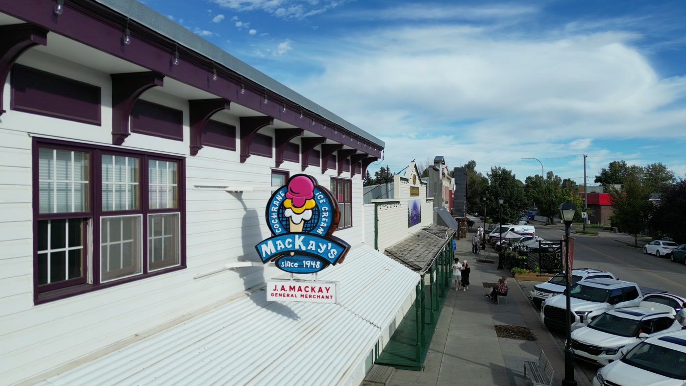
A long-running maker's roundel, founding year included, on a white clapboard shopfront. Made in Cochrane, Alberta.MacKay's Ice Cream 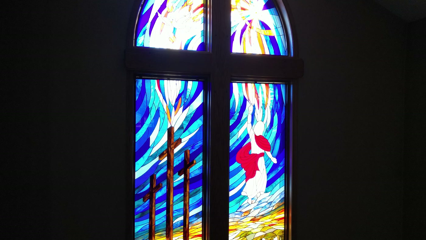
A stained-glass window above a chancel: three crosses on a hill and blue rays across the sky. Made in Cochrane, Alberta.St. Peter's Lutheran Church 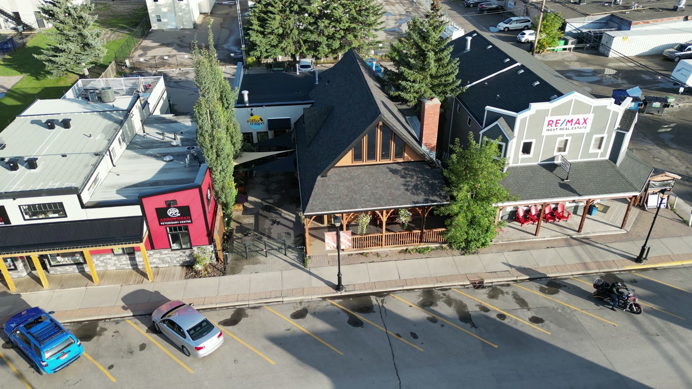
A timber-gabled café between its neighbours on a main street, seen from above in long shadows. Made in Cochrane, Alberta.Cochrane Coffee Traders


What we make for Medicine Hat.
- Places and landmarks
- Brand and campaign films
- Farms and ranch land
- Hospitality and tourism
- Cafés, restaurants and shops
Every subject is approached the same way — creative direction, film, photography, aerial and post-production, scoped and quoted before anything is booked.
Medicine Hat and what surrounds it.
- Film and photography in Lethbridge159 km · Class E control zone (CYQL) across downtown, the river valley and the university
- Film and photography in Hussar183 km · Class G uncontrolled
- Film and photography in Rosebud208 km · Class G uncontrolled
- Film and photography in Standard210 km · Class G uncontrolled
- Film and photography in Drumheller214 km · Class G uncontrolled, with a restricted area south-east of town
Named in Medicine Hat
Medalta in the Historic Clay DistrictSaamis TepeeFinlay BridgeEsplanade Arts & Heritage CentreRiverside Veterans' Memorial ParkPolice Point ParkStrathcona Island ParkKin Coulee ParkEcho Dale Regional ParkCo-op Place
How a Medicine Hat shoot runs.
- 01Brief and scope. Medicine Hat lends itself to places and landmarks and brand and campaign films; the shot list follows the subject. Mobilisation is stated separately from the fee.
- 02Airspace, where the brief includes aerial work. Medicine Hat sits under Medicine Hat Regional Airport (CYXH), 4 km away. Authorisation is filed with NAV CANADA and the date is confirmed once it is in hand.
- 03Light and weather. Environment and Climate Change Canada's 1981–2010 normals at the airport put the mean wind at 13.5 km/h, from the southwest in every month — windiest in April and May (15.1 km/h), calmest in August (11.6 km/h), with 12 days a year at 52 km/h or more. Chinooks soften the winter cold, but wind chill still falls below −20 on about 43 days a year, which shortens battery and crew time outdoors. Environment and Climate Change Canada's normals record 2,544 hours of bright sunshine a year and 330 days with measurable sunshine — the basis of the '330 days of sunshine' Tourism Medicine Hat promotes — with July at 353.5 hours, 71.7% of the possible daylight. A 21 June day runs from 05:13 to 21:36, the sunset about 19 minutes ahead of Calgary's, and July and August afternoons are dry, near 35–37% humidity. June is the wettest month at 65.4 mm, and January snow averages only 6 cm deep.
- 04Shoot day. About 3.2 hours from the Calgary base. Launch from the subject property with the owner's permission; the City of Medicine Hat's Parks Bylaw 4859, passed in 2025, keeps drones out of every City park — boulevards and park sidewalks included — except in areas the City Manager designates, and the City lists those launch sites as still to be announced; a drone of 250 g or more also needs a City Manager permit. Commercial operators should be ready to show a City business licence and proof of insurance, and the working default is to launch from the client's own property with consent.
- 05Post-production and delivery. Edited, graded and finished for every format and market it will live in, delivered digitally — which is how owners of Medicine Hat property who live elsewhere, anywhere in the world, are served by a global agency.
Medicine Hat questions, answered.
Medicine Hat calls itself Canada's Drone City — does that make aerial filming easier there?
Not inside the city. The City's aerospace page places its drone firms between CFB Suffield and the Foremost test range, both Class F restricted airspace that no aircraft enters without authorisation, while Medicine Hat itself sits inside the airport's Class E control zone, so every commercial flight in town needs an Advanced certificate and a NAV CANADA authorisation through NAV Drone. City parks add a second gate: Parks Bylaw 4859 allows drones only in designated areas, and none has been announced.
Can a drone take off from Police Point Park or another City of Medicine Hat park?
Not yet. Parks Bylaw 4859, passed in September 2025, bars drones from every City park — including boulevards, park roadways and the sidewalks beside them — except in areas the City Manager designates, and the City lists those approved launch sites as still to be announced; a drone of 250 g or more also needs a City Manager permit. Police Point Park's trees, which the City says are up to 300 years old, are filmed from the ground or from private land outside the park.
Can Medalta in the Historic Clay District host a brand film or shoot?
Yes, by arrangement with Medalta. The National Historic Site — a museum, contemporary ceramic arts facility, gallery and community hub in a converted century-old factory — rents event space, including a Reception Gallery of 50 by 100 feet that seats up to 200, and its interiors and grounds are booked directly with the venue. Aerials of the 150-acre district are a separate matter: it sits inside the airport's control zone, so they wait on a NAV Drone authorisation.
Can a Medicine Hat production add aerials over Cypress Hills or the Suffield prairie?
Only with permissions that are not routine. Cypress Hills Provincial Park, about 48 km south-southeast, bans recreational drones, and commercial take-off needs an Alberta Parks filming permit application with $1,000,000 in insurance and no guarantee of approval, while CFB Suffield's restricted airspace, beginning about 20 km north, is closed to any flight without its Operations Officer's authorisation. Fort Walsh National Historic Site, about 78 km southeast in Saskatchewan, is a Parks Canada no-drone zone for recreational use.
We're a national brand based outside Alberta — what does a Medicine Hat shoot need from us?
Very little on site. Creative direction and the review of cuts run remotely, production travels about 295 km from the Calgary base by road, and the studio handles what the City asks of operators based elsewhere — a Medicine Hat business licence and proof of insurance — along with each NAV Drone authorisation. The client covers travel at cost. Visiting teams fly into Calgary: WestJet's scheduled service at Medicine Hat Regional ended on June 24, 2026.
Medicine Hat is 159 km from Lethbridge.
Mobilisation is quoted from the Calgary base, so a shoot in Medicine Hat and one 159 km away in Lethbridge are priced differently even when the subject is identical.
Nearby
Airspace record derived from the published airspace geometry on . Rules change — the exact site is confirmed against NAV Drone before every flight.