Lethbridge, Alberta
Agri-food and brand film in Lethbridge.
Atom2Adam, a global creative consultancy and media agency operating from Calgary, takes commissions in Lethbridge: brand films for southern Alberta's agri-food economy, photography for its venues and campus, and aerial cinematography over the Oldman River coulees, filed with NAV CANADA and the City before the shoot.
From the work

No published project is placed in Lethbridge; this film and the frames below are shown because their subjects — a working farm at harvest, river-and-rail country, a main street from above — match what its commissions ask for.
Does Atom2Adam work in Lethbridge?
Yes. Atom2Adam, a global creative consultancy and media agency operating from Calgary, makes film, photography and aerial cinematography in Lethbridge, Alberta — for homes, businesses and brands. For aerial work the airspace is Class E control zone (CYQL) across downtown, the river valley and the university. Aerial work here flies under an Advanced RPAS certificate, and the airspace authorisation is filed before any shoot date is confirmed. From the Calgary base, mobilisation is typically 2.5 hours.
Agriculture pays for Lethbridge; the coulees and the bridge make it look like nowhere else.
Agriculture and agri-food account for nearly 20% of the Lethbridge region's GDP, according to Economic Development Lethbridge, on nearly one million irrigated acres of potatoes, canola, corn, lentils, sugar beets and more than 65 specialty crops, and global food processors operate in the region. Agriculture and Agri-Food Canada's Lethbridge Research and Development Centre has worked there since 1906. For Atom2Adam, that is the brand film: the field, the plant and the people between them.
Lethbridge's calendar is built on farming and gathering. Ag Expo, which bills itself as Southern Alberta's largest farm technology show, drew more than 300 exhibitors in 2025, and Whoop-Up Days has filled the 72-acre exhibition grounds every August for more than 125 years, with the Lethbridge & District Pro Rodeo at its centre. The VisitLethbridge.com Arena seats up to 5,900, and the University of Lethbridge — about 8,000 students from nearly 100 countries — sits in the coulees in Arthur Erickson's University Hall.
Lethbridge already courts the screen. In 2023 City Council funded a permitting role and an economic-development role focused on attracting the film industry, and the High Level Bridge appears in episode four of HBO's The Last of Us. That bridge — the CPR's 1909 viaduct over the Oldman River — is the landmark a campaign, a tourism film or a recruitment piece for the city will want, and the one that takes the most permissions to fly.
The work, in the order Lethbridge needs it.
- 01
Film
Brand and recruitment films for southern Alberta's agri-food processors, growers and research firms — the irrigated field, the plant and the people between them.
- 02
Aerial
Aerial cinematography of the coulees, the High Level Bridge and irrigated farmland, with NAV CANADA authorisation through NAV Drone inside the CYQL zone and the City's flight plan lodged with the film permit.
- 03
Photography
Photography for Ag Expo exhibitors, the university's architecture and the venues of the exhibition grounds and the VisitLethbridge.com Arena.
- 04
Consultancy & Creative Direction
Schedules built around a ten-day City permit lead time, a west wind that averages 18.3 km/h and a weather-day buffer for chinook season.
- 05
Post-Production
Edits, colour and sound finished for trade-show screens, investor decks and campaign cuts, delivered to head offices outside Alberta.
Lethbridge at a glance
| Agency | Global creative consultancy & media agency |
|---|---|
| Operating base | Calgary, Alberta, Canada |
| Drive from the base | 2.5 hours |
| Airspace | Class E control zone (CYQL) across downtown, the river valley and the university |
| Nearest aerodrome | Lethbridge Airport (CYQL) |
| Aerial authorisation | Yes — filed before the date is confirmed |
| Aerial status | Flown under airspace authorisation |
| Certification | Transport Canada RPAS — Advanced Operations |
| Response | We reply within one business day |
| Airspace record derived | 2026-10-05 |
Working in Lethbridge.
The High Level Bridge crosses the Oldman River 95 m above the valley floor, on coulees deep enough to hold Lethbridge's river parks, trails and a university below the line of the prairie. From the rim a frame holds the bridge and none of the valley; from the floor it holds the trestle and none of the city — and almost every vantage between sits inside the airport's control zone.
Bridge and coulee work is planned from both levels, filed with NAV CANADA through NAV Drone before the date is confirmed, and lodged with the City as a flight plan alongside the film permit.
Light. Clear skies peak in July, August and September on Environment and Climate Change Canada's 1971–2000 normals, at 254–272 hours a month with 0–2 tenths cloud, while December and January are the most overcast. A 21 June day runs from 5:23 a.m. to 9:42 p.m., and with Alberta on Alberta Time year-round from November 2026, the 21 December sun sets at 5:33 p.m. after about 8 hours of daylight. Snow cover is unreliable: an average January has only 17 days with 1 cm or more on the ground.
Terrain. The Oldman River meanders through the centre of Lethbridge and divides it east from west, and the CPR's High Level Bridge spans its valley at more than 1,600 m long and 95 m high, a measure of how deep the coulees cut below the prairie. Cottonwoods form a dense canopy on the valley floor — the City counts it among the few places in the world where three cottonwood species grow — and more than 100 km of trail wind through the valley. Beyond the rim, nearly one million irrigated acres surround the city.
Wind. Environment and Climate Change Canada's 1981–2010 normals at Lethbridge Airport put the mean wind at 18.3 km/h, most often from the west in every month, and strongest in December and January (20.5–20.8 km/h). The 1971–2000 record counts 80 days a year with winds of 52 km/h or more, and The Canadian Encyclopedia notes that one in three winter days in southwestern Alberta is a chinook day, so a Lethbridge booking carries a weather-day buffer.
Airspace. Most of Lethbridge — downtown, the Oldman River valley parks, the High Level Bridge, the University of Lethbridge and Nikka Yuko — lies inside the 5 NM Class E control zone around Lethbridge Airport (CYQL), as charted in NAV CANADA's Designated Airspace Handbook; City Hall is about 7.5 km from its centre. Flights there need an Advanced certificate and an RPAS Flight Authorization from NAV CANADA, requested through NAV Drone, and downtown also sits about 1.5 km from the certified Chinook Regional Hospital heliport. Only the north and far-west edges of the city fall outside the zone, and the specific site is confirmed against NAV Drone before every flight.
On the ground. Every commercial production filming in Lethbridge files the City's film permit at least ten days ahead, and aerial work adds a flight plan — take-off, landing and route — that Lethbridge Airport may review, plus a rental or occupancy permit for any park, where Parks Bylaw 5651 bars launching or landing an airborne device without one. The working default is to launch from private land with the owner's consent. About 2.5 hours and 215–225 km from the Calgary base, by Hwy 2 and Hwy 3 or by Hwy 23, and Lethbridge has had no scheduled passenger flights since June 2026. A full shoot is booked with an overnight, and the City's ten-day film-permit lead time sets the earliest date.
What gets commissioned in Lethbridge.
Agri-food brand film
A film for a processor, grower or seed business that follows a crop from irrigated field to plant, timed to the harvest it depends on.
Ag Expo exhibitor content
Films and stills made around Southern Alberta's largest farm technology show each February, indoors and along its outdoor Machinery Row.
Coulee and bridge campaign
Aerial and ground film of the High Level Bridge and the Oldman River valley for tourism, civic or campaign use, made under the full City and NAV CANADA approvals.
Campus architecture
Photography and film of University Hall and Science Commons, the university's 1971 and 2019 buildings above the river.
Frames from the work
None of these frames comes from a project placed in Lethbridge; each caption says where its frame was made, or that the record does not say.
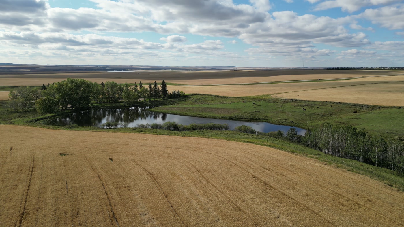
Pale stubble and dark worked ground in broad strips, rolling upland and cumulus beyond. Where it was made is not recorded.Grain and Cattle 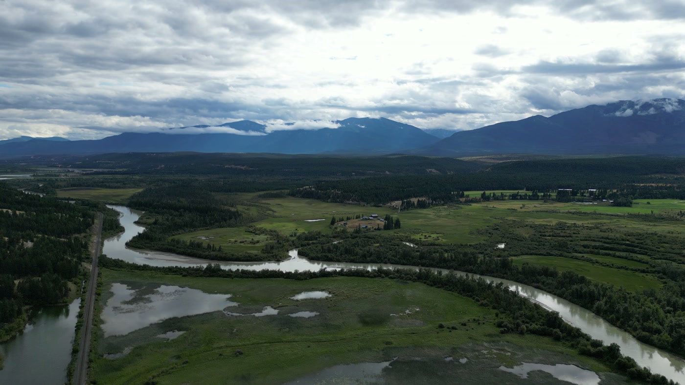
A river's S-bend through wetland, a railway beside it and a farmstead on the bench above. Made in Radium Hot Springs, British Columbia.Fields and Forest 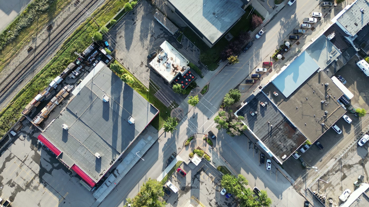
A main-street block from straight above: rooftops, kerbside parking and a rail line running past. Made in Cochrane, Alberta.Found Books & Shop


What we make for Lethbridge.
- Farms and ranch land
- Brand and campaign films
- Places and landmarks
- Hospitality and tourism
- Cafés, restaurants and shops
Every subject is approached the same way — creative direction, film, photography, aerial and post-production, scoped and quoted before anything is booked.
Lethbridge and what surrounds it.
- Film and photography in Nanton100 km · Class G uncontrolled
- Film and photography in Cayley115 km · Class G uncontrolled
- Film and photography in High River123 km · Class G uncontrolled
- Film and photography in Longview132 km · Class G uncontrolled
- Film and photography in Aldersyde136 km · Class G uncontrolled, local aerodrome nearby
Named in Lethbridge
High Level BridgeOldman River valleyUniversity HallNikka Yuko Japanese GardenHenderson Lake ParkIndian Battle ParkFort Whoop Up Interpretive CentreGalt GardensHelen Schuler Nature CentreVisitLethbridge.com Arena
How a Lethbridge shoot runs.
- 01Brief and scope. Lethbridge lends itself to farms and ranch land and brand and campaign films; the shot list follows the subject. Mobilisation is stated separately from the fee.
- 02Airspace, where the brief includes aerial work. Lethbridge sits under Lethbridge Airport (CYQL), 7.5 km away. Authorisation is filed with NAV CANADA and the date is confirmed once it is in hand.
- 03Light and weather. Environment and Climate Change Canada's 1981–2010 normals at Lethbridge Airport put the mean wind at 18.3 km/h, most often from the west in every month, and strongest in December and January (20.5–20.8 km/h). The 1971–2000 record counts 80 days a year with winds of 52 km/h or more, and The Canadian Encyclopedia notes that one in three winter days in southwestern Alberta is a chinook day, so a Lethbridge booking carries a weather-day buffer. Clear skies peak in July, August and September on Environment and Climate Change Canada's 1971–2000 normals, at 254–272 hours a month with 0–2 tenths cloud, while December and January are the most overcast. A 21 June day runs from 5:23 a.m. to 9:42 p.m., and with Alberta on Alberta Time year-round from November 2026, the 21 December sun sets at 5:33 p.m. after about 8 hours of daylight. Snow cover is unreliable: an average January has only 17 days with 1 cm or more on the ground.
- 04Shoot day. About 2.5 hours from the Calgary base. Launch from the subject property with the owner's permission; every commercial production filming in Lethbridge files the City's film permit at least ten days ahead, and aerial work adds a flight plan — take-off, landing and route — that Lethbridge Airport may review, plus a rental or occupancy permit for any park, where Parks Bylaw 5651 bars launching or landing an airborne device without one. The working default is to launch from private land with the owner's consent.
- 05Post-production and delivery. Edited, graded and finished for every format and market it will live in, delivered digitally — which is how owners of Lethbridge property who live elsewhere, anywhere in the world, are served by a global agency.
Lethbridge questions, answered.
Can a drone film the High Level Bridge in Lethbridge?
Yes, with three approvals. The bridge sits just inside the Class E control zone around Lethbridge Airport on the published geometry, so it needs a NAV CANADA authorisation through NAV Drone, and the City requires a film permit filed ten days ahead with a flight plan Lethbridge Airport may review, plus a park permit for any launch in the valley. The CPR built the viaduct between 1907 and 1909; Parks Canada calls it, at more than 1,600 m long and 95 m high, the longest and highest of its kind in Canada.
Does a commercial shoot in Lethbridge need a City film permit?
Yes. The City of Lethbridge asks every production — film, series, commercials, documentaries and music videos — to complete its film permit form at least ten days before filming, with $2 million in liability insurance naming the City, a rental or occupancy permit for parks and trails, and production hours of 7 a.m. to 10 p.m. from Monday to Saturday. Its production guidelines also ask for $25 million in aviation liability for any means of flight, and whether that covers a small drone is confirmed with the City's film office before a quote is written.
Are drones allowed at Nikka Yuko Japanese Garden?
No. The garden's rules say drones are not allowed at any time and there is no drone photography or filming, and commercial photo and film shoots must be booked in advance through the garden. It also sits about 0.7 km from the hospital heliport and inside the airport's control zone, so the rule and the airspace point the same way. Ground-level film there follows the garden's own calendar: crabapple blossom in spring, then peonies, then red and gold maples in autumn.
Can you film on Kainai Nation land near Lethbridge?
Only with the Nation's permission. Blood 148, the Kainai Nation's primary reserve and the largest First Nation reserve by area in Canada, lies southwest of the city, and Blood Tribe Land Management administers the permits for land use there; the City's Indigenous Relations Office is the starting point for protocol and for filming on Indigenous land. The reserve's nearest boundary is about 8 km southwest of City Hall, so coulee shots from the west side are planned with it in mind.
Our brand is outside Alberta and can't send a team — how does a Lethbridge shoot run?
Remotely, from your side. Creative direction and the review of cuts happen online, and production travels from the Calgary base, about 2.5 hours by road, because Lethbridge has had no scheduled passenger flights since WestJet's last Calgary–Lethbridge service on June 24, 2026. Visiting teams fly into Calgary, and the client covers travel at cost. Alberta stays on Alberta Time (UTC−6) year-round from November 2026 — worth knowing when review calls cross time zones.
Lethbridge is 100 km from Nanton.
Mobilisation is quoted from the Calgary base, so a shoot in Lethbridge and one 100 km away in Nanton are priced differently even when the subject is identical.
Nearby
Airspace record derived from the published airspace geometry on . Rules change — the exact site is confirmed against NAV Drone before every flight.